Latitude: 51.291 / 51°17'27"N
Longitude: 0.3791 / 0°22'44"E
OS Eastings: 565983
OS Northings: 157335
OS Grid: TQ659573
Mapcode National: GBR NPB.STS
Mapcode Global: VHJM4.JT87
Plus Code: 9F3279RH+9J
Entry Name: Hodges Place
Listing Date: 30 May 1984
Grade: II
Source: Historic England
Source ID: 1264822
English Heritage Legacy ID: 426910
ID on this website: 101264822
Location: Tower Hill, Tonbridge and Malling, Kent, ME19
County: Kent
District: Tonbridge and Malling
Civil Parish: Offham
Built-Up Area: Offham
Traditional County: Kent
Lieutenancy Area (Ceremonial County): Kent
Church of England Parish: Offham St Michael
Church of England Diocese: Rochester
Tagged with: Building
TQ6457-6557 OFFHAM C.P. CHURCH ROAD
8/13 (east side)
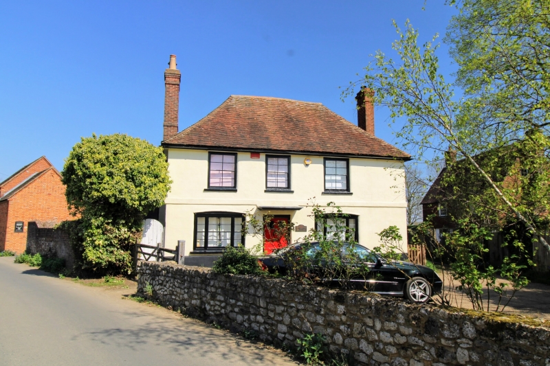
Hodges Place
II
Farmhouse. C17. Painted brick infilling to timber-frame, tile-hung above. Plain
tiled roof with end stacks with projecting breasts. 2 storeys and garrets;
2 windows, glazing bar sashes. Central ½-glazed door in 4-centred arched surround.
Catslide extension to rear with later additions.
Listing NGR: TQ6598357335
External links are from the relevant listing authority and, where applicable, Wikidata. Wikidata IDs may be related buildings as well as this specific building. If you want to add or update a link, you will need to do so by editing the Wikidata entry.


Other nearby listed buildings