Latitude: 51.3016 / 51°18'5"N
Longitude: -0.5379 / 0°32'16"W
OS Eastings: 502026
OS Northings: 156850
OS Grid: TQ020568
Mapcode National: GBR GD4.8V0
Mapcode Global: VHFV8.MKH0
Plus Code: 9C3X8F26+MR
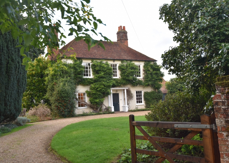
Entry Name: The Old Vicarage
Listing Date: 22 July 1953
Grade: II
Source: Historic England
Source ID: 1236262
English Heritage Legacy ID: 290737
ID on this website: 101236262
Location: Old Woking, Woking, Surrey, GU22
County: Surrey
District: Woking
Electoral Ward/Division: Hoe Valley
Parish: Non Civil Parish
Built-Up Area: Woking
Traditional County: Surrey
Lieutenancy Area (Ceremonial County): Surrey
Church of England Parish: Woking St Peter
Church of England Diocese: Guildford
Tagged with: Clergy house
TQ 05NW BOROUGH OF WOKING CHURCH STREET (west side) OLD WOKING 6/36 The Old Vicarage 22/7/53 II GV House c1800. Colourwashed brick, hipped plain tiled roof, end stacks to left and right. 2 storeys with rendered plat band between; 3 bays, glazing bar sash windows. Central half glazed door under flat porch hood on chamfered wooden supports.
Forms a group with the Church of St. Peter.
Listing NGR: TQ0202456852
External links are from the relevant listing authority and, where applicable, Wikidata. Wikidata IDs may be related buildings as well as this specific building. If you want to add or update a link, you will need to do so by editing the Wikidata entry.


Other nearby listed buildings