Approximate Location Map
Large Map »
Latitude: 51.493 / 51°29'34"N
Longitude: -0.1517 / 0°9'6"W
OS Eastings: 528408
OS Northings: 178735
OS Grid: TQ284787
Mapcode National: GBR BL.3Z
Mapcode Global: VHGQZ.BQ4V
Plus Code: 9C3XFRVX+58
Entry Name: 23-35, South Eaton Place SW1
Listing Date: 1 December 1987
Grade: II
Source: Historic England
Source ID: 1236479
English Heritage Legacy ID: 427478
ID on this website: 101236479
Location: Belgravia, Westminster, London, SW1W
County: London
District: City of Westminster
Electoral Ward/Division: Knightsbridge and Belgravia
Parish: Non Civil Parish
Built-Up Area: City of Westminster
Traditional County: Middlesex
Lieutenancy Area (Ceremonial County): Greater London
Church of England Parish: St Michael Chester Square
Church of England Diocese: London
Tagged with: Building
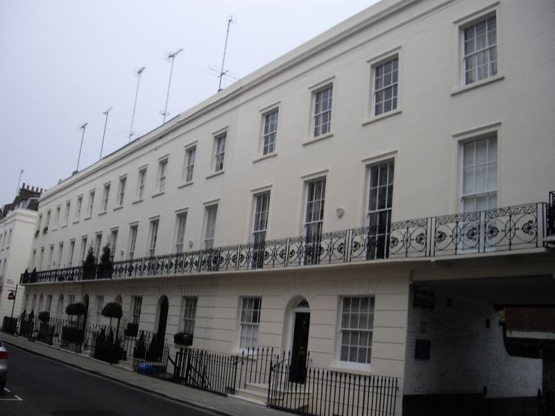
TQ 2878 NW CITY OF WESTMINSTER SOUTH EATON PLACE, SW1
102/26 (East Side)
Nos 23 to 35 (odd)
G.V. II
Row of houses. Early C19. Stucco. Roof not visible. 3 storeys and basement.
Each house 2 windows wide. Round headed entrances, panelled doors channelling to
ground floor. First floor continuous cast iron anthemion pattern balcony.
Square headed windows, architraved above ground floor. Sashes; glazing bars
mostly survive. Cornice above second floor. Cast iron area railings.
Listing NGR: TQ2840878735
External links are from the relevant listing authority and, where applicable, Wikidata. Wikidata IDs may be related buildings as well as this specific building. If you want to add or update a link, you will need to do so by editing the Wikidata entry.


Other nearby listed buildings
