Latitude: 52.0643 / 52°3'51"N
Longitude: 1.1438 / 1°8'37"E
OS Eastings: 615592
OS Northings: 245327
OS Grid: TM155453
Mapcode National: GBR TMP.G0W
Mapcode Global: VHLBS.SC1T
Plus Code: 9F43347V+PG
Entry Name: Walls to Number 65
Listing Date: 4 August 1994
Grade: II
Source: Historic England
Source ID: 1237502
English Heritage Legacy ID: 428794
ID on this website: 101237502
Location: Ipswich, Suffolk, IP1
County: Suffolk
District: Ipswich
Electoral Ward/Division: St Margaret's
Parish: Non Civil Parish
Built-Up Area: Ipswich
Traditional County: Suffolk
Lieutenancy Area (Ceremonial County): Suffolk
Church of England Parish: St Matthew Triangle and All Saints
Church of England Diocese: St.Edmundsbury and Ipswich
Tagged with: Wall
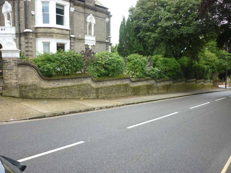
IPSWICH
TM1545 ANGLESEA ROAD
642-0/6/10052 (South side)
Walls to No.65
GV II
Walls. c1880. White brick. Gate piers with ornamental caps and
linked by C20 iron gates standing at corner of Anglesea Road
and ramped walls with brick copings extend either side.
Listing NGR: TM1559245327
External links are from the relevant listing authority and, where applicable, Wikidata. Wikidata IDs may be related buildings as well as this specific building. If you want to add or update a link, you will need to do so by editing the Wikidata entry.


Other nearby listed buildings