Approximate Location Map
Large Map »
Latitude: 51.745 / 51°44'42"N
Longitude: -2.2153 / 2°12'55"W
OS Eastings: 385228
OS Northings: 205168
OS Grid: SO852051
Mapcode National: GBR 1MK.JQV
Mapcode Global: VH94Y.KD6M
Plus Code: 9C3VPQWM+2V
Entry Name: 28 and 29, High Street
Listing Date: 1 May 1951
Grade: II
Source: Historic England
Source ID: 1238228
English Heritage Legacy ID: 415674
ID on this website: 101238228
Location: Stroud, Gloucestershire, GL5
County: Gloucestershire
District: Stroud
Civil Parish: Stroud
Built-Up Area: Stroud
Traditional County: Gloucestershire
Lieutenancy Area (Ceremonial County): Gloucestershire
Church of England Parish: Stroud St Laurence
Church of England Diocese: Gloucester
Tagged with: Building
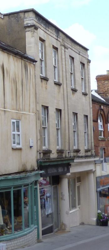
1. HIGH STREET
5227
(South Side)
Nos 28 & 29
SO 8505 5/57 1.5.51.
II
2.
Early c19. (1823?). Brick faced in ashlar. 2 shops with continuous fascia
supported by original Doric columns, 3 storeys. 2 windows each(double-hung
sash and glazing bars). Pilasters through upper floors with caps enriched with
egg-and-dart and plain parapet.
Listing NGR: SO8522805168
External links are from the relevant listing authority and, where applicable, Wikidata. Wikidata IDs may be related buildings as well as this specific building. If you want to add or update a link, you will need to do so by editing the Wikidata entry.


Other nearby listed buildings
