Approximate Location Map
Large Map »
Latitude: 51.3828 / 51°22'58"N
Longitude: 0.2161 / 0°12'58"E
OS Eastings: 554314
OS Northings: 167193
OS Grid: TQ543671
Mapcode National: GBR TS.R4S
Mapcode Global: VHHP6.PHMS
Plus Code: 9F3296M8+4F
Entry Name: 28, London Road
Listing Date: 22 October 1982
Grade: II
Source: Historic England
Source ID: 1238232
English Heritage Legacy ID: 415682
ID on this website: 101238232
Location: Farningham, Sevenoaks, Kent, DA4
County: Kent
District: Sevenoaks
Civil Parish: Farningham
Built-Up Area: Eynsford
Traditional County: Kent
Lieutenancy Area (Ceremonial County): Kent
Church of England Parish: Farningham St Peter and St Paul
Church of England Diocese: Rochester
Tagged with: Building
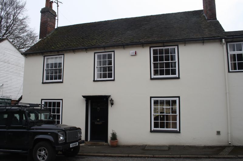
FARNINGHAM LONDON ROAD
1.
5280
No 28
TQ 5467 9/133
II GV
2.
C18. Two storeys stuccoed. Slate roof with modillion cornice. Three sashes
with glazing bars intact. Doorcase with flat wooden hood on console brackets.
Six panelled door, the top 2 panels cut away and glazed.
Listing NGR: TQ5431067194
External links are from the relevant listing authority and, where applicable, Wikidata. Wikidata IDs may be related buildings as well as this specific building. If you want to add or update a link, you will need to do so by editing the Wikidata entry.


Other nearby listed buildings
