Approximate Location Map
Large Map »
Latitude: 50.73 / 50°43'48"N
Longitude: -1.1521 / 1°9'7"W
OS Eastings: 459941
OS Northings: 92608
OS Grid: SZ599926
Mapcode National: GBR 9CN.3K9
Mapcode Global: FRA 87G4.YT5
Plus Code: 9C2WPRJX+25
Entry Name: 36, the Strand
Listing Date: 18 May 1972
Grade: II
Source: Historic England
Source ID: 1238720
English Heritage Legacy ID: 416336
ID on this website: 101238720
Location: St John's Park, Isle of Wight, PO33
County: Isle of Wight
Civil Parish: Ryde
Built-Up Area: Ryde
Traditional County: Hampshire
Lieutenancy Area (Ceremonial County): Isle of Wight
Church of England Parish: Oakfield St John
Church of England Diocese: Portsmouth
Tagged with: Building
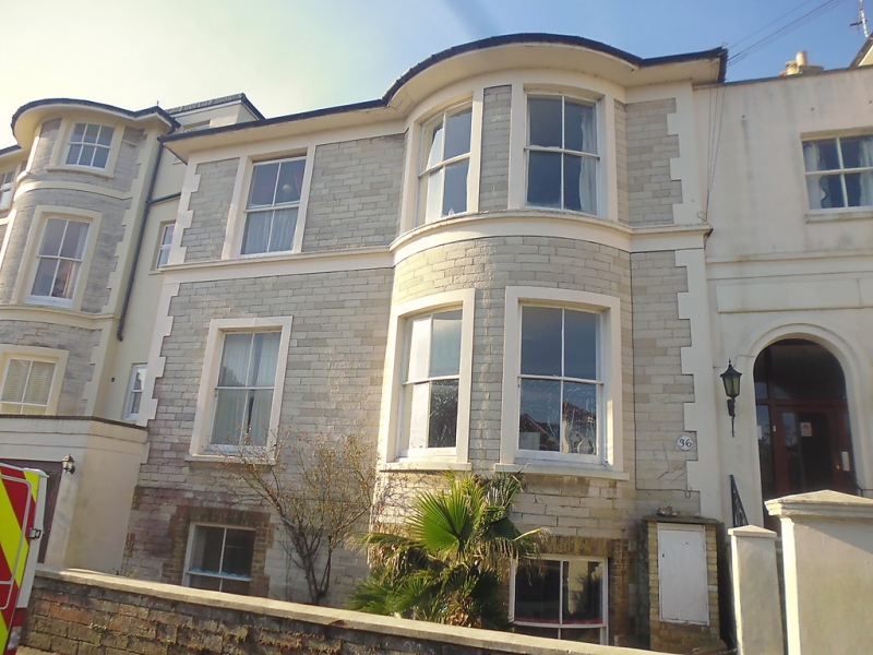
THE STRAND
1.
1577
(South Side)
No 36
SZ 5992 3/333
II GV
2.
Circa 1840/50 detached villa similar to No 31 of two storeys and basement but
only three windows, two in bow through both storeys to West. Similar porch to
that of No 31 on West side with modern door. Turned balusters flanking steps
with capped piers.
Nos 31 to 38 (consec) form a group.
Listing NGR: SZ5994192608
External links are from the relevant listing authority and, where applicable, Wikidata. Wikidata IDs may be related buildings as well as this specific building. If you want to add or update a link, you will need to do so by editing the Wikidata entry.


Other nearby listed buildings
