Approximate Location Map
Large Map »
Latitude: 50.7301 / 50°43'48"N
Longitude: -1.152 / 1°9'7"W
OS Eastings: 459946
OS Northings: 92619
OS Grid: SZ599926
Mapcode National: GBR 9CN.3LB
Mapcode Global: FRA 87G4.YVD
Plus Code: 9C2WPRJX+26
Entry Name: Front Wall of No 36
Listing Date: 18 May 1972
Grade: II
Source: Historic England
Source ID: 1274053
English Heritage Legacy ID: 416337
ID on this website: 101274053
Location: St John's Park, Isle of Wight, PO33
County: Isle of Wight
Civil Parish: Ryde
Built-Up Area: Ryde
Traditional County: Hampshire
Lieutenancy Area (Ceremonial County): Isle of Wight
Church of England Parish: Oakfield St John
Church of England Diocese: Portsmouth
Tagged with: Wall
THE STRAND
1.
1577
(South Side)
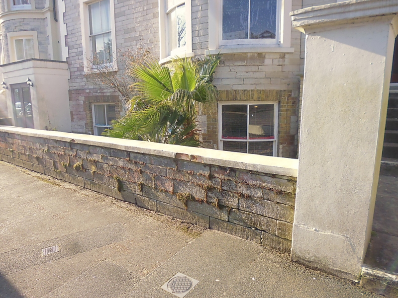
Front wall of No 36
SZ 5992 3/333A
II
2.
Low stone wall with rendered X pattern balustrade with coping, rendered
capped piers.
Listing NGR: SZ5994692619
External links are from the relevant listing authority and, where applicable, Wikidata. Wikidata IDs may be related buildings as well as this specific building. If you want to add or update a link, you will need to do so by editing the Wikidata entry.


Other nearby listed buildings
