Approximate Location Map
Large Map »
Latitude: 51.4062 / 51°24'22"N
Longitude: 0.1973 / 0°11'50"E
OS Eastings: 552928
OS Northings: 169759
OS Grid: TQ529697
Mapcode National: GBR TR.0G3
Mapcode Global: VHHP0.CXPC
Plus Code: 9F32C54W+FW
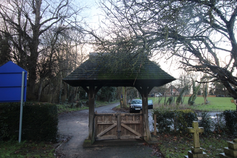
Entry Name: Lychgate to west of Church of Saint Paul
Listing Date: 22 October 1982
Last Amended: 1 February 1983
Grade: II
Source: Historic England
Source ID: 1239132
English Heritage Legacy ID: 416878
ID on this website: 101239132
Location: St Paul's Church, Swanley Village, Sevenoaks, Kent, BR8
County: Kent
District: Sevenoaks
Civil Parish: Swanley
Built-Up Area: Swanley
Traditional County: Kent
Lieutenancy Area (Ceremonial County): Kent
Church of England Parish: Swanley St Paul
Church of England Diocese: Rochester
Tagged with: Architectural structure
This list entry was subject to a Minor Amendment on 9 September 2021 to remove superfluous amendment details and to reformat the text to current standards
TQ 5269
8/232
SWANLEY
Swanley Village
SCHOOL LANE (North side)
Lychgate to west of Church of St Paul
GV
II
Mid C19. Two crownpost formations supporting hipped roof covered with shingles. Surmounted by wrought iron cross. Included for group value.
Listing NGR: TQ5292869759
External links are from the relevant listing authority and, where applicable, Wikidata. Wikidata IDs may be related buildings as well as this specific building. If you want to add or update a link, you will need to do so by editing the Wikidata entry.


Other nearby listed buildings
