Latitude: 53.3664 / 53°21'58"N
Longitude: -0.9611 / 0°57'40"W
OS Eastings: 469224
OS Northings: 386002
OS Grid: SK692860
Mapcode National: GBR PYQH.QZ
Mapcode Global: WHFG2.6NK4
Plus Code: 9C5X928Q+GG
Entry Name: Alpha House and Outbuilding
Listing Date: 27 November 1984
Grade: II
Source: Historic England
Source ID: 1239185
English Heritage Legacy ID: 416960
ID on this website: 101239185
Location: Lound, Bassetlaw, Nottinghamshire, DN22
County: Nottinghamshire
District: Bassetlaw
Civil Parish: Lound
Built-Up Area: Lound
Traditional County: Nottinghamshire
Lieutenancy Area (Ceremonial County): Nottinghamshire
Church of England Parish: Sutton-cum-Lound
Church of England Diocese: Southwell and Nottingham
Tagged with: Architectural structure
SK 68 NE LOUND TOWN STREET (east side)
3/80 Alpha House and outbuilding
G.V. II
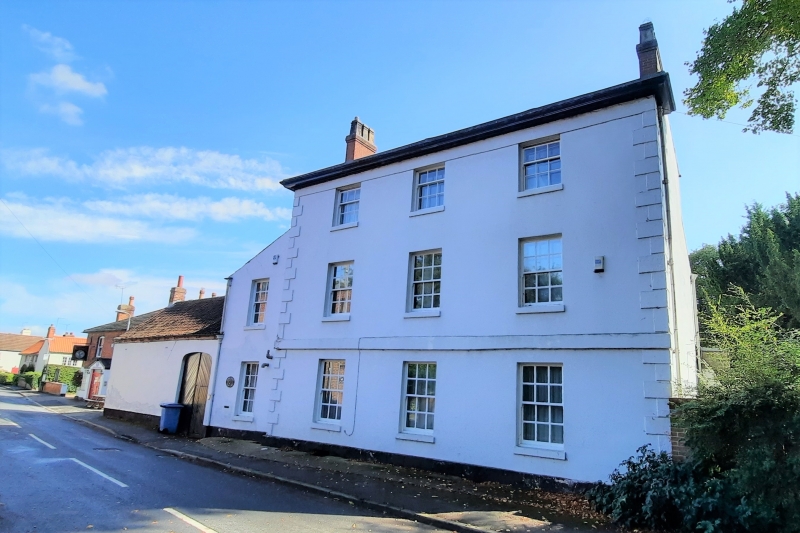
House, c,1800. Rendered brick. With projecting quoins, slate roof, 2 red brick gable stacks, moulded cornice and eaves band. 2.1/2 storeys, 3 bays, set on a plinth with a 1st floor band. 3 glazing bar sashes, 3 similar sashes above and 3 similar smaller sashes on the top floor. To the left is a 2 storey single bay lean-to, set on a plinth with a single glazing bar sash on each floor. Further left is a single storey outbuilding with pantile roof and red brick single gable stack. Having 2 doorways, one under a segmental head, the other with double wooden doors, there are 2 tie plates.
Listing NGR: SK6922486002
External links are from the relevant listing authority and, where applicable, Wikidata. Wikidata IDs may be related buildings as well as this specific building. If you want to add or update a link, you will need to do so by editing the Wikidata entry.


Other nearby listed buildings