Approximate Location Map
Large Map »
Latitude: 50.7213 / 50°43'16"N
Longitude: -3.514 / 3°30'50"W
OS Eastings: 293226
OS Northings: 92391
OS Grid: SX932923
Mapcode National: GBR P1.94HT
Mapcode Global: FRA 37J5.GV8
Plus Code: 9C2RPFCP+GC
Entry Name: Penleonard Place
Listing Date: 29 January 1953
Grade: II
Source: Historic England
Source ID: 1239530
English Heritage Legacy ID: 417361
ID on this website: 101239530
Location: St Leonard's, Exeter, Devon, EX2
County: Devon
District: Exeter
Electoral Ward/Division: Newtown and St Leonard's
Parish: Non Civil Parish
Built-Up Area: Exeter
Traditional County: Devon
Lieutenancy Area (Ceremonial County): Devon
Church of England Parish: Exeter St Leonard
Church of England Diocese: Exeter
Tagged with: Building
MAGDALEN ROAD
1.
1092
(South Side)
Nos 64 and 66
(Penleonard Place)
SX 9392 13/266 29.1.53.
II
2.
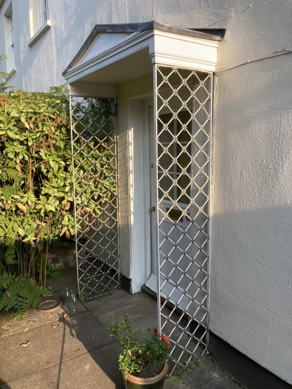
Early C19. Stucco pair, two storeys, four windows, sashes with glazing bars.
Good iron trellis porches with pediments. Slurry roof with pediment to the central
gable.
Listing NGR: SX9322692391
External links are from the relevant listing authority and, where applicable, Wikidata. Wikidata IDs may be related buildings as well as this specific building. If you want to add or update a link, you will need to do so by editing the Wikidata entry.


Other nearby listed buildings
