Approximate Location Map
Large Map »
Latitude: 51.3595 / 51°21'34"N
Longitude: 1.4443 / 1°26'39"E
OS Eastings: 639886
OS Northings: 167900
OS Grid: TR398679
Mapcode National: GBR Y1L.L0Q
Mapcode Global: VHMCW.Z3F4
Plus Code: 9F339C5V+QP
Entry Name: Wall to the North East of Flint House
Listing Date: 20 September 1974
Grade: II
Source: Historic England
Source ID: 1239602
English Heritage Legacy ID: 417389
ID on this website: 101239602
Location: Broadstairs, Thanet, Kent, CT10
County: Kent
District: Thanet
Civil Parish: Broadstairs and St. Peters
Built-Up Area: Broadstairs
Traditional County: Kent
Lieutenancy Area (Ceremonial County): Kent
Tagged with: Wall
HARBOUR STREEET
1.
5283 East Side)
(North East Side)
BROADSTAIRS
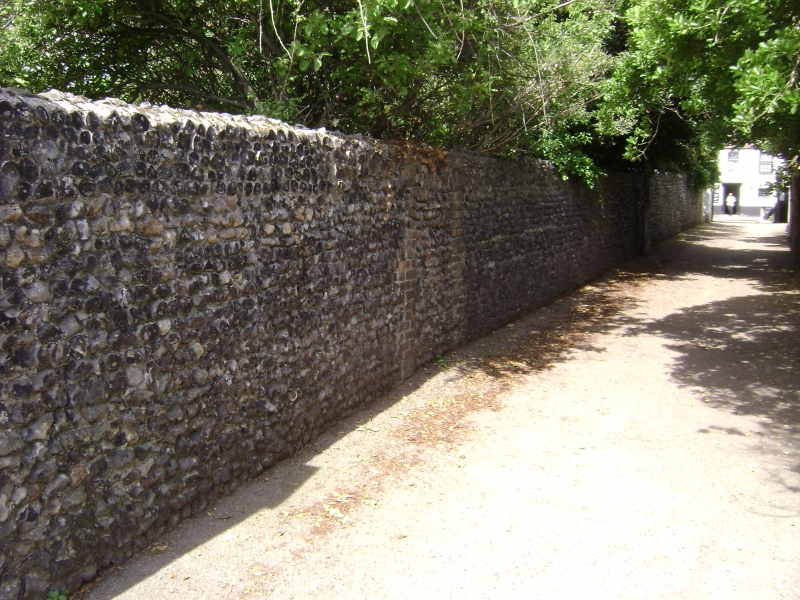
Wall to the north-east
of Flint House
TR 3967 NE 1/104A
II
2.
C19. A 6 ft high flint wall with stock brick pilasters at regular intervals.
Listing NGR: TR3988667900
External links are from the relevant listing authority and, where applicable, Wikidata. Wikidata IDs may be related buildings as well as this specific building. If you want to add or update a link, you will need to do so by editing the Wikidata entry.


Other nearby listed buildings
