Approximate Location Map
Large Map »
Latitude: 51.3593 / 51°21'33"N
Longitude: 1.4444 / 1°26'39"E
OS Eastings: 639889
OS Northings: 167877
OS Grid: TR398678
Mapcode National: GBR Y1L.L0S
Mapcode Global: VHMCW.Z3F9
Plus Code: 9F339C5V+PP
Entry Name: The York Gate
Listing Date: 24 January 1950
Grade: II
Source: Historic England
Source ID: 1273644
English Heritage Legacy ID: 417394
ID on this website: 101273644
Location: Broadstairs, Thanet, Kent, CT10
County: Kent
District: Thanet
Civil Parish: Broadstairs and St. Peters
Built-Up Area: Broadstairs
Traditional County: Kent
Lieutenancy Area (Ceremonial County): Kent
Tagged with: Gate
1.
5283
TR 3967 NE
1/8
24.1.50
HARBOUR STREET
(North East Side)
BROADSTAIRS
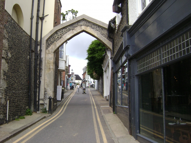
The York Gate
II
2.
Built about 1540, repaired in 1795. A pointed arch with grooves for a portcullis
built over the street with a bastion on the south-west side but on the north-east
side only the groove in which the portcullis fitted remains.
Listing NGR: TR3988967877
External links are from the relevant listing authority and, where applicable, Wikidata. Wikidata IDs may be related buildings as well as this specific building. If you want to add or update a link, you will need to do so by editing the Wikidata entry.


Other nearby listed buildings
