Approximate Location Map
Large Map »
Latitude: 51.4992 / 51°29'57"N
Longitude: -0.253 / 0°15'10"W
OS Eastings: 521361
OS Northings: 179254
OS Grid: TQ213792
Mapcode National: GBR 9M.6WS
Mapcode Global: VHGQX.KLL2
Plus Code: 9C3XFPXW+MQ
Entry Name: 56, Woodstock Road W4
Listing Date: 2 February 1970
Grade: II
Source: Historic England
Source ID: 1240374
English Heritage Legacy ID: 438791
ID on this website: 101240374
Location: Bedford Park, Hounslow, London, W4
County: London
District: Hounslow
Electoral Ward/Division: Southfield
Parish: Non Civil Parish
Built-Up Area: Ealing
Traditional County: Middlesex
Lieutenancy Area (Ceremonial County): Greater London
Church of England Parish: St Michael and All Angels Bedford Park
Church of England Diocese: London
Tagged with: Building
1.
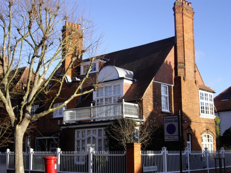
4419 WOODSTOCK ROAD W4
(Bedford Park)
No 56
TQ 2179 SW 5/16 2.2.70.
II
2.
2 storeys. Shaped gable above porch. Single-storeyed bay with timber
railing and arched window above rising into roof as dormer. Some alteration.
3 piers to front garden.
Listing NGR: TQ2136179254
External links are from the relevant listing authority and, where applicable, Wikidata. Wikidata IDs may be related buildings as well as this specific building. If you want to add or update a link, you will need to do so by editing the Wikidata entry.


Other nearby listed buildings
