Approximate Location Map
Large Map »
Latitude: 51.2807 / 51°16'50"N
Longitude: 1.0798 / 1°4'47"E
OS Eastings: 614879
OS Northings: 158006
OS Grid: TR148580
Mapcode National: GBR TY2.PSH
Mapcode Global: VHLGM.N2PL
Plus Code: 9F3373JH+7W
Entry Name: 1, King Street
Listing Date: 7 September 1973
Grade: II
Source: Historic England
Source ID: 1240861
English Heritage Legacy ID: 439404
ID on this website: 101240861
Location: Canterbury, Kent, CT1
County: Kent
District: Canterbury
Electoral Ward/Division: Westgate
Parish: Non Civil Parish
Built-Up Area: Canterbury
Traditional County: Kent
Lieutenancy Area (Ceremonial County): Kent
Tagged with: Building
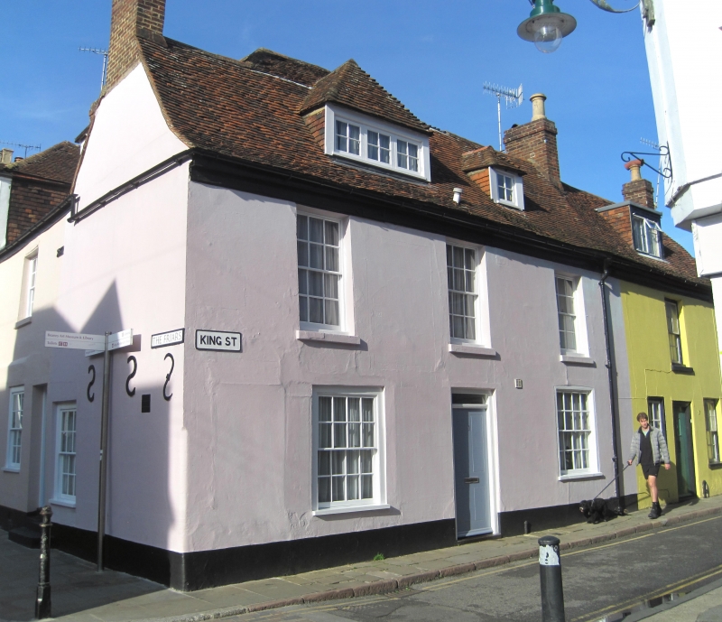
1.
944 KING STREET
(North West Side)
No 1
TR 1458 SE 2/521
II GV
2.
Early C18. 2 storeys stuccoed. Old tiled roof with 2 hipped dormers. 3 sashes
with glazing bars intact and wooden cills. Ground floor has 2 simple wooden
doorcases with elongated rectangular fanlight and flush panelled door.
nos 1 and 2 together with Nos 7 to 9 (consec) The Friars form a group.
Listing NGR: TR1487858012
External links are from the relevant listing authority and, where applicable, Wikidata. Wikidata IDs may be related buildings as well as this specific building. If you want to add or update a link, you will need to do so by editing the Wikidata entry.


Other nearby listed buildings
