Approximate Location Map
Large Map »
Latitude: 51.2807 / 51°16'50"N
Longitude: 1.0798 / 1°4'47"E
OS Eastings: 614883
OS Northings: 158013
OS Grid: TR148580
Mapcode National: GBR TY2.PTK
Mapcode Global: VHLGM.N2QJ
Plus Code: 9F3373JH+7W
Entry Name: 2, King Street
Listing Date: 7 September 1973
Grade: II
Source: Historic England
Source ID: 1260807
English Heritage Legacy ID: 439405
ID on this website: 101260807
Location: Canterbury, Kent, CT1
County: Kent
District: Canterbury
Electoral Ward/Division: Westgate
Parish: Non Civil Parish
Built-Up Area: Canterbury
Traditional County: Kent
Lieutenancy Area (Ceremonial County): Kent
Tagged with: Building
1.
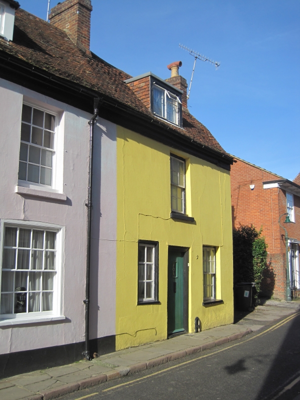
944 KING STREET
(North West Side)
No 2
TR 1458 SE 2/521
II GV
2.
An extension to No 1. Early C18. 2 storeys colour-washed. Old tiled roof
with 1 restored dormer. 1 sash on first floor. 2 on ground floor. Simple
doorcase with moulded architrave.
Nos 1 and 2 together with Nos 7 to 9 (consec) The Friars form a group.
Listing NGR: TR1488158016
External links are from the relevant listing authority and, where applicable, Wikidata. Wikidata IDs may be related buildings as well as this specific building. If you want to add or update a link, you will need to do so by editing the Wikidata entry.


Other nearby listed buildings
