Latitude: 51.0666 / 51°3'59"N
Longitude: -1.7899 / 1°47'23"W
OS Eastings: 414818
OS Northings: 129721
OS Grid: SU148297
Mapcode National: GBR 51F.492
Mapcode Global: FRA 7649.GHW
Plus Code: 9C3W3686+M2
Entry Name: 109, Dolphin Street
Listing Date: 12 October 1972
Grade: II
Source: Historic England
Source ID: 1240910
English Heritage Legacy ID: 319091
ID on this website: 101240910
Location: The Friary, Wiltshire, SP1
County: Wiltshire
Civil Parish: Salisbury
Built-Up Area: Salisbury
Traditional County: Wiltshire
Lieutenancy Area (Ceremonial County): Wiltshire
Church of England Parish: Salisbury St Martin
Church of England Diocese: Salisbury
Tagged with: Building
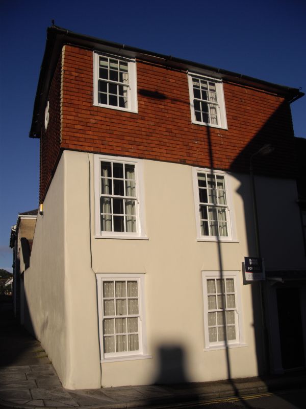
DOLPHIN STREET
1.
1594
No 109
SU 1429 NE 4/191
II GV
2.
Early C19. ] storeys stucco faced. Low pitch hipped slate roof, flat eaves.
2 windows on all floors, one blind 2nd floor, flush architrave sashes, later
glazing, ground and 1st floor windows have stucco keystones. Recessed 4 panel
door to right hand.
Nos 109 to 119 (odd) form a group wtih No 53 St Anne's Street.
Listing NGR: SU1481829721
External links are from the relevant listing authority and, where applicable, Wikidata. Wikidata IDs may be related buildings as well as this specific building. If you want to add or update a link, you will need to do so by editing the Wikidata entry.


Other nearby listed buildings