Approximate Location Map
Large Map »
Latitude: 51.2811 / 51°16'51"N
Longitude: 1.0806 / 1°4'50"E
OS Eastings: 614938
OS Northings: 158054
OS Grid: TR149580
Mapcode National: GBR TY2.Q07
Mapcode Global: VHLGM.P248
Plus Code: 9F3373JJ+C7
Entry Name: The Prince of Wales Inn
Listing Date: 3 May 1967
Grade: II
Source: Historic England
Source ID: 1240916
English Heritage Legacy ID: 439485
ID on this website: 101240916
Location: Canterbury, Kent, CT1
County: Kent
District: Canterbury
Electoral Ward/Division: Westgate
Parish: Non Civil Parish
Built-Up Area: Canterbury
Traditional County: Kent
Lieutenancy Area (Ceremonial County): Kent
Tagged with: Inn
1.
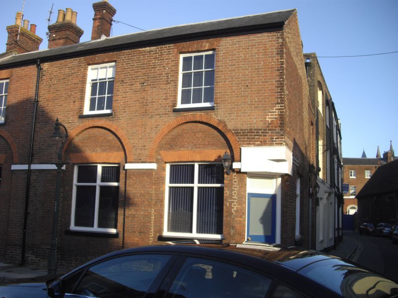
944 KING STREET
(South East Side)
No 5l (The Prince of
Wales Inn)
TR 1458 SE 2/303 3.5.67.
II
2.
C18. 2 storeys red brick. Slate roof with parapet, 5 windows with glazing
bars intact. 3 round-headed arched recessed on ground floor. See Nos 2-7
St Alphege Lane.
Listing NGR: TR1494258054
External links are from the relevant listing authority and, where applicable, Wikidata. Wikidata IDs may be related buildings as well as this specific building. If you want to add or update a link, you will need to do so by editing the Wikidata entry.


Other nearby listed buildings
