Approximate Location Map
Large Map »
Latitude: 51.281 / 51°16'51"N
Longitude: 1.0807 / 1°4'50"E
OS Eastings: 614942
OS Northings: 158045
OS Grid: TR149580
Mapcode National: GBR TY2.Q1B
Mapcode Global: VHLGM.P25B
Plus Code: 9F3373JJ+97
Entry Name: 2, St Alphege Lane
Listing Date: 7 September 1973
Grade: II
Source: Historic England
Source ID: 1241657
English Heritage Legacy ID: 440828
ID on this website: 101241657
Location: Canterbury, Kent, CT1
County: Kent
District: Canterbury
Electoral Ward/Division: Westgate
Parish: Non Civil Parish
Built-Up Area: Canterbury
Traditional County: Kent
Lieutenancy Area (Ceremonial County): Kent
Tagged with: Building
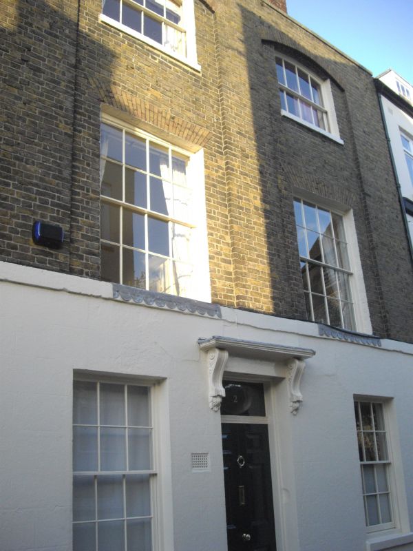
1.
944 ST ALPHEGE LANE
(North East Side)
No 2
TR 1458 SE 2/332
II GV
2.
C17 refaced in late C18. 3 storeys buff brick. Ground floor stuccoed. 2
sashes set in cambered arched recesses. Stringcourse. Doorcase has vestigial
hood on 2 moulded console brackets. Rectangular fanlight and 6 Panelled door.
Nos 2 to 6 (consec) form a group with Nos 10 & 11 Palace Street.
Listing NGR: TR1494558048
External links are from the relevant listing authority and, where applicable, Wikidata. Wikidata IDs may be related buildings as well as this specific building. If you want to add or update a link, you will need to do so by editing the Wikidata entry.


Other nearby listed buildings
