Approximate Location Map
Large Map »
Latitude: 51.2833 / 51°16'59"N
Longitude: 1.0682 / 1°4'5"E
OS Eastings: 614061
OS Northings: 158262
OS Grid: TR140582
Mapcode National: GBR TY2.DWY
Mapcode Global: VHLGM.G0LL
Plus Code: 9F3373M9+87
Entry Name: 35-38, London Road
Listing Date: 7 September 1973
Grade: II
Source: Historic England
Source ID: 1241022
English Heritage Legacy ID: 439646
ID on this website: 101241022
Location: St Dunstan's, Canterbury, Kent, CT2
County: Kent
District: Canterbury
Electoral Ward/Division: Westgate
Parish: Non Civil Parish
Built-Up Area: Canterbury
Traditional County: Kent
Lieutenancy Area (Ceremonial County): Kent
Tagged with: Building
1.
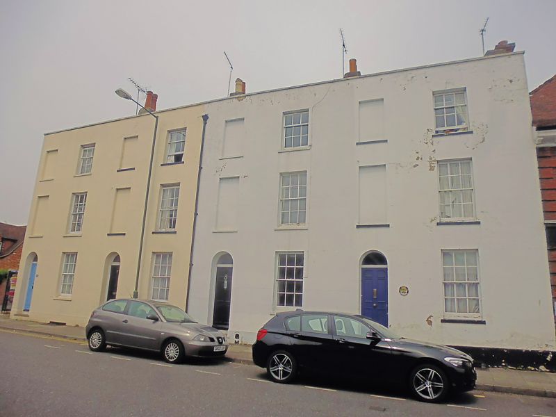
944 LONDON ROAD
(North West Side)
Nos 35 to 38 (consec)
TR 1458 SW 1/542
II GV
2.
An early C19 terrace. 3 storeys and basements stuccoed. Stone coping, 1 sash
with glazing bars intact and 1 blank to each. Stone cills, Plinth. Simple
round-headed doorcases without glazing bars. Nos 35 and 36 have original 6
panelled doors.
Nos 35 to 38 (consec) form a group.
Listing NGR: TR1406858267
External links are from the relevant listing authority and, where applicable, Wikidata. Wikidata IDs may be related buildings as well as this specific building. If you want to add or update a link, you will need to do so by editing the Wikidata entry.


Other nearby listed buildings
