Latitude: 51.1507 / 51°9'2"N
Longitude: 0.2196 / 0°13'10"E
OS Eastings: 555334
OS Northings: 141388
OS Grid: TQ553413
Mapcode National: GBR MPJ.VQ0
Mapcode Global: VHHQC.RBFR
Plus Code: 9F325629+7R
Entry Name: Lychgate to Churchyard of the Church of St Mary the Virgin
Listing Date: 24 August 1990
Grade: II
Source: Historic England
Source ID: 1241400
English Heritage Legacy ID: 439536
ID on this website: 101241400
Location: Speldhurst, Tunbridge Wells, Kent, TN3
County: Kent
District: Tunbridge Wells
Civil Parish: Speldhurst
Built-Up Area: Speldhurst
Traditional County: Kent
Lieutenancy Area (Ceremonial County): Kent
Church of England Parish: Speldhurst St Mary the Virgin
Church of England Diocese: Rochester
Tagged with: Lychgate
TQ 55 41 SPELDHURST SPELDHURST HILL (north side), SPELDHURST 12/544 Lychgate to churchyard of the Church of St Mary the Virgin GV II
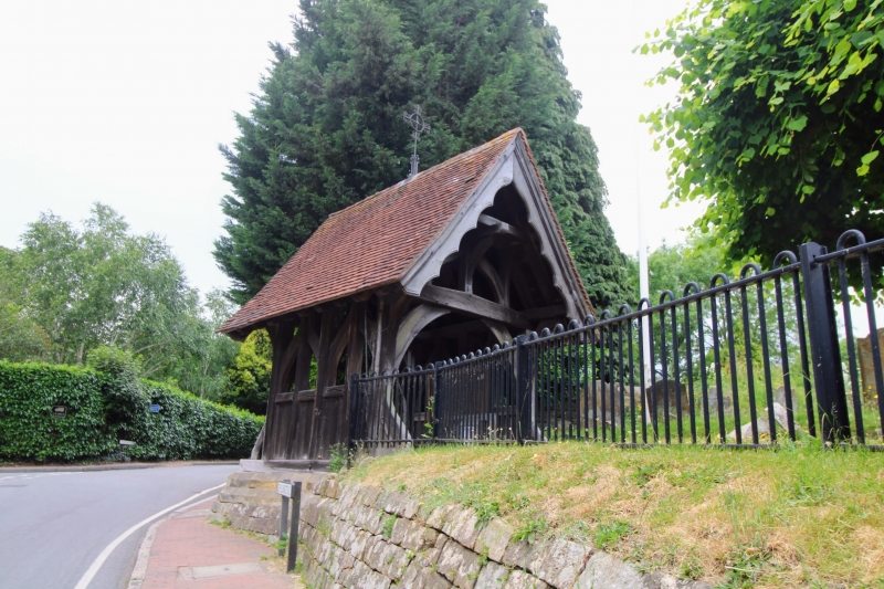
Lychgate. Late C19. Timber-framed on low sandstone ashlar footings, peg-tile roof. Gothic style lychgate side-walls of 4 narrow bays, boarded below the middle rail and open above with wavy braces. The sills extend front and back to take wavy tension braces. Front and back gable ends have arch-braced tie beam trusses. Square crown posts above with wavy down braces. Steeply pitched roof projects both ends and has cusped bargeboards. It is surmounted by a wrought iron cross. Low double gates also with wavy braces and good original shaped iron hinges.
The lychgate is one of a good group of listed buildings in the vicinity of the Church of St Mary (q.v.)
Listing NGR: TQ5533441388
External links are from the relevant listing authority and, where applicable, Wikidata. Wikidata IDs may be related buildings as well as this specific building. If you want to add or update a link, you will need to do so by editing the Wikidata entry.


Other nearby listed buildings