Latitude: 51.1515 / 51°9'5"N
Longitude: 1.1117 / 1°6'42"E
OS Eastings: 617713
OS Northings: 143745
OS Grid: TR177437
Mapcode National: GBR TZN.RW6
Mapcode Global: VHLH7.7B22
Plus Code: 9F335426+JM
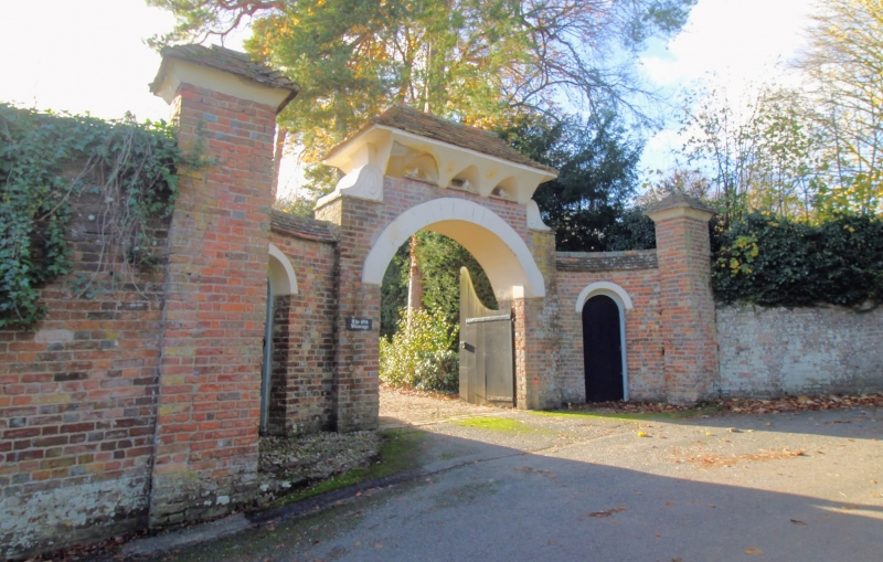
Entry Name: Gate Piers and Wall About 33 Metres North of the Old Vicarage
Listing Date: 17 October 1988
Grade: II
Source: Historic England
Source ID: 1241665
English Heritage Legacy ID: 440608
ID on this website: 101241665
Location: Elham, Folkestone and Hythe, Kent, CT4
County: Kent
District: Folkestone and Hythe
Civil Parish: Elham
Built-Up Area: Elham
Traditional County: Kent
Lieutenancy Area (Ceremonial County): Kent
Tagged with: Gatepost
TR 1643-1743 ELHAM VICARAGE LANE (south side)
9/91 Gate Piers and wall about 33 metres north of The Old Vicarage
GV II
Gatepiers and garden wall. C18. Gateway adapted in early C20. Two pairs of brick gatepiers. Curved wall in header bond with plain- tile coping, between inner and outer pier of each pair. Round-headed doorway with painted voussoirs and boarded door to each curved wall. Outer piers have pyramidal plain-tile caps with coved plastered soffits. Inner piers support broad semi-circular arch, above which is a device with hipped plain-tile roof and coved plastered soffit pierced at base to resemble dovecote. This is flanked by inverted plaster scrolls terminating on top of,piers. Pair of shaped wooden gates. Garden wall, red and grey brick in a mixed bond, running east from gateway for about 36 metres, about 3 metres high, with battered top. Flint footings towards east end.
Listing NGR: TR1771443746
External links are from the relevant listing authority and, where applicable, Wikidata. Wikidata IDs may be related buildings as well as this specific building. If you want to add or update a link, you will need to do so by editing the Wikidata entry.


Other nearby listed buildings