Latitude: 51.2821 / 51°16'55"N
Longitude: 1.0749 / 1°4'29"E
OS Eastings: 614535
OS Northings: 158149
OS Grid: TR145581
Mapcode National: GBR TY2.GLH
Mapcode Global: VHLGM.L14H
Plus Code: 9F3373JF+RX
Entry Name: 11, St DUNSTAN'S STREET (See details for further address information)
Listing Date: 3 May 1967
Grade: II
Source: Historic England
Source ID: 1241788
English Heritage Legacy ID: 441025
ID on this website: 101241788
Location: Canterbury, Kent, CT2
County: Kent
District: Canterbury
Electoral Ward/Division: Westgate
Parish: Non Civil Parish
Built-Up Area: Canterbury
Traditional County: Kent
Lieutenancy Area (Ceremonial County): Kent
Tagged with: Building
1. 944 ST DUNSTAN'S STREET (North East Side)
No 11 Nos 12 & 12A No 13 TR 1458 SE 2/317 3.5.67.
II GV
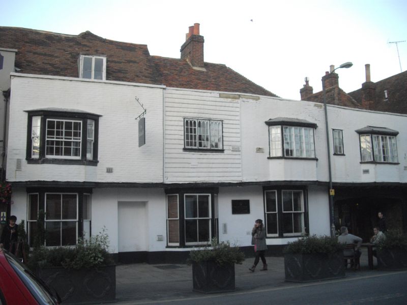
2. Timber-framed buildings, refaced in the C18, not uniform. 2 storeys and attics, faced with painted brick and stucco. The 1st floor ovevsails. Tiled roof with parapet Moder n windows and shopfronts. No 11 is faced with tiles and has a C19 metal casement with 'Gothic' glazing. No 13 had been recently refaced and cement rendered.
nos 5 to 16 (consec) form a group.
Listing NGR: TR1454058164
External links are from the relevant listing authority and, where applicable, Wikidata. Wikidata IDs may be related buildings as well as this specific building. If you want to add or update a link, you will need to do so by editing the Wikidata entry.


Other nearby listed buildings