Approximate Location Map
Large Map »
Latitude: 51.2817 / 51°16'54"N
Longitude: 1.075 / 1°4'30"E
OS Eastings: 614542
OS Northings: 158112
OS Grid: TR145581
Mapcode National: GBR TY2.GMQ
Mapcode Global: VHLGM.L15R
Plus Code: 9F3373JG+M2
Entry Name: 89 and 90, St Dunstan's Street
Listing Date: 3 May 1967
Grade: II
Source: Historic England
Source ID: 1260296
English Heritage Legacy ID: 441178
ID on this website: 101260296
Location: Canterbury, Kent, CT2
County: Kent
District: Canterbury
Electoral Ward/Division: Westgate
Parish: Non Civil Parish
Built-Up Area: Canterbury
Traditional County: Kent
Lieutenancy Area (Ceremonial County): Kent
Tagged with: Building
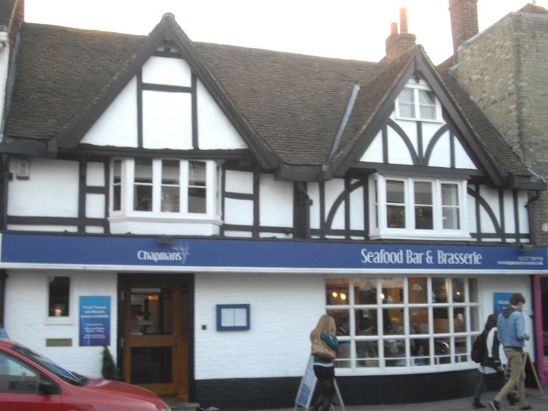
1.
944 ST DUNSTAN'S STREET
(South West Side)
Nos 89 & 90
TR 1458 SE 2/122 3.5.67.
II GV
2.
A timber-framed building restored in the late C19, 2 storeys, ground floor
brick, 1st floor restored timber training with plaster infill. Tiled roof.
2 gables with pendants. Attic window. 1st floor has 2 bays. Modern shopfront
with Georgian style bow.
Nos 87 to 95 (consec), Garden Wall & gate piers to No 87 form a group.
Listing NGR: TR1454258107
External links are from the relevant listing authority and, where applicable, Wikidata. Wikidata IDs may be related buildings as well as this specific building. If you want to add or update a link, you will need to do so by editing the Wikidata entry.


Other nearby listed buildings
