Approximate Location Map
Large Map »
Latitude: 51.2824 / 51°16'56"N
Longitude: 1.0735 / 1°4'24"E
OS Eastings: 614437
OS Northings: 158187
OS Grid: TR144581
Mapcode National: GBR TY2.G7D
Mapcode Global: VHLGM.K1D6
Plus Code: 9F3373JF+XC
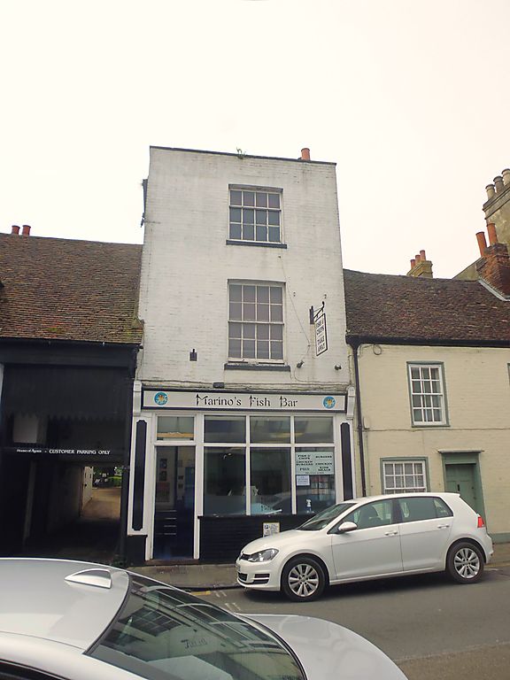
Entry Name: 70, St Dunstan's Street
Listing Date: 7 September 1973
Grade: II
Source: Historic England
Source ID: 1241875
English Heritage Legacy ID: 441123
ID on this website: 101241875
Location: St Dunstan's, Canterbury, Kent, CT2
County: Kent
District: Canterbury
Electoral Ward/Division: Westgate
Parish: Non Civil Parish
Built-Up Area: Canterbury
Traditional County: Kent
Lieutenancy Area (Ceremonial County): Kent
Tagged with: Building
1.
944 ST DUNSTAN'S STREET
(South West Side)
No 70
TR 1458 SW 1/659
II GV
2.
Early C19. 3 storeys painted brick, Hipped toed roof with stone coping.
1 sash with glazing bars intact. Later shopfront.
Nos 67 to 81 (consec) form a group.
Listing NGR: TR1443258179
External links are from the relevant listing authority and, where applicable, Wikidata. Wikidata IDs may be related buildings as well as this specific building. If you want to add or update a link, you will need to do so by editing the Wikidata entry.


Other nearby listed buildings
