Approximate Location Map
Large Map »
Latitude: 51.2826 / 51°16'57"N
Longitude: 1.0731 / 1°4'23"E
OS Eastings: 614408
OS Northings: 158207
OS Grid: TR144582
Mapcode National: GBR TY2.G54
Mapcode Global: VHLGM.K152
Plus Code: 9F3373MF+37
Entry Name: 65 and 66, St Dunstan's Street
Listing Date: 7 September 1973
Grade: II
Source: Historic England
Source ID: 1260312
English Heritage Legacy ID: 441120
ID on this website: 101260312
Location: St Dunstan's, Canterbury, Kent, CT2
County: Kent
District: Canterbury
Electoral Ward/Division: Westgate
Parish: Non Civil Parish
Built-Up Area: Canterbury
Traditional County: Kent
Lieutenancy Area (Ceremonial County): Kent
Tagged with: Building
1.
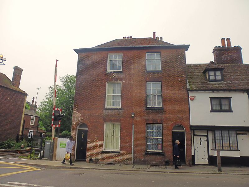
944 ST DUNSTAN'S STREET
(South West Side)
Nos 65 & 66
TR 1458 SW 1/116A
II GV
2.
Early C19. 2 parallel ranges 3 storeys red brick. Hipped tiled roof with
wooden eaves cornice. 2 windows with glazing bars intact, Round-headed doorways
with semi-circular fanlights.
Nos 51 to 66 (consec) form a group.
Listing NGR: TR1440558206
External links are from the relevant listing authority and, where applicable, Wikidata. Wikidata IDs may be related buildings as well as this specific building. If you want to add or update a link, you will need to do so by editing the Wikidata entry.


Other nearby listed buildings
