Latitude: 51.421 / 51°25'15"N
Longitude: -1.7276 / 1°43'39"W
OS Eastings: 419040
OS Northings: 169150
OS Grid: SU190691
Mapcode National: GBR 4X2.VD1
Mapcode Global: VHC1P.0JKZ
Plus Code: 9C3WC7CC+CX
Entry Name: 16 and 17, the Parade
Listing Date: 21 October 1974
Grade: II
Source: Historic England
Source ID: 1243053
English Heritage Legacy ID: 446504
ID on this website: 101243053
Location: Marlborough, Wiltshire, SN8
County: Wiltshire
Civil Parish: Marlborough
Built-Up Area: Marlborough
Traditional County: Wiltshire
Lieutenancy Area (Ceremonial County): Wiltshire
Tagged with: Building
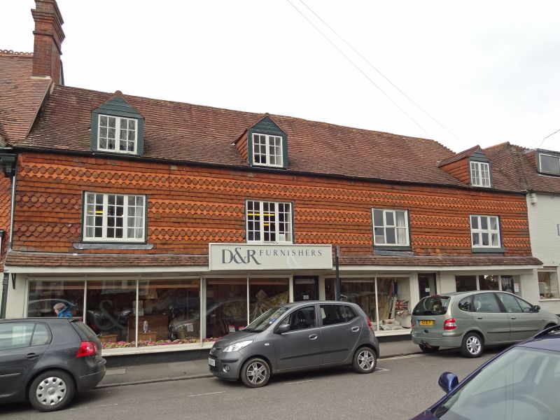
THE PARADE
1.
5407
(East Side)
Nos 16 and 17
SU 1969 1/285
II GV
2.
Cl8, altered. Ground floor rendered. Ornamental tile hung lst floor. Pitched
old tile roof. 2 storeys and attics. Cl9 plate glass shop fronts to ground
floor. 4 C19 casements on 1st floor. 3 attic dormers, tile-hung cheeks, with
casements.
Nos 16 to 18 (consec) form a group.
Listing NGR: SU1904069150
External links are from the relevant listing authority and, where applicable, Wikidata. Wikidata IDs may be related buildings as well as this specific building. If you want to add or update a link, you will need to do so by editing the Wikidata entry.


Other nearby listed buildings