Latitude: 51.3279 / 51°19'40"N
Longitude: -2.0115 / 2°0'41"W
OS Eastings: 399293
OS Northings: 158753
OS Grid: ST992587
Mapcode National: GBR 2V6.N88
Mapcode Global: VHB4G.2WYF
Plus Code: 9C3V8XHQ+59
Entry Name: Stable to Rear of No 35 (The Crofts)
Listing Date: 3 April 1987
Grade: II
Source: Historic England
Source ID: 1243108
English Heritage Legacy ID: 446639
ID on this website: 101243108
Location: Potterne, Wiltshire, SN10
County: Wiltshire
Civil Parish: Potterne
Built-Up Area: Potterne
Traditional County: Wiltshire
Lieutenancy Area (Ceremonial County): Wiltshire
Tagged with: Stable
ST 9958 POTTERNE WHISTLEY ROAD
(west side)
14/174 Stable to rear of No 35
(The Crofts)
GV II
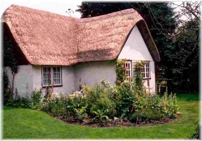
Stable, C18, painted brick with thatched roof, hipped to south,
half-hipped to north. East side board door and window. North
end door and window with weatherboarded gable above and plank
loading door.
Listing NGR: ST9929358753
External links are from the relevant listing authority and, where applicable, Wikidata. Wikidata IDs may be related buildings as well as this specific building. If you want to add or update a link, you will need to do so by editing the Wikidata entry.


Other nearby listed buildings