Latitude: 51.0668 / 51°4'0"N
Longitude: -1.7921 / 1°47'31"W
OS Eastings: 414663
OS Northings: 129736
OS Grid: SU146297
Mapcode National: GBR 51F.3Q6
Mapcode Global: FRA 7649.FN6
Plus Code: 9C3W3685+P5
Entry Name: 14-20, Trinity Street
Listing Date: 12 October 1972
Grade: II
Source: Historic England
Source ID: 1243264
English Heritage Legacy ID: 446919
ID on this website: 101243264
Location: The Friary, Wiltshire, SP1
County: Wiltshire
Civil Parish: Salisbury
Built-Up Area: Salisbury
Traditional County: Wiltshire
Lieutenancy Area (Ceremonial County): Wiltshire
Church of England Parish: Salisbury St Martin
Church of England Diocese: Salisbury
Tagged with: Building
TRINITY STREET 1. 1594 (South Side) Nos 14 to 20 (even)
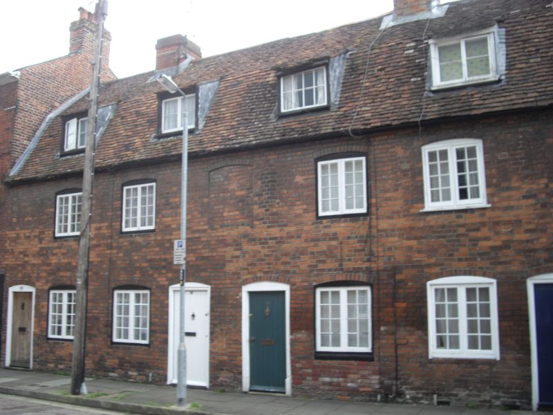
SU 1429 NE 4/139 II GV 2. Group of late C18/early C19 red brick cottages. 2 storeys and attic. Old tile mansard roof. Each cottage has 1 dormer with Yorkshire casements. 2 light casement 1st floor. 1 similar window and ledged door on ground floor. Windows have segmental heads. The cottages are arranged with 2 doors in the centre with brick panel at lst floor level over and one door in each outer corner.
Nos 14 to 46 (even) form a group with No 71A Brown Street.
Listing NGR: SU1466729733
External links are from the relevant listing authority and, where applicable, Wikidata. Wikidata IDs may be related buildings as well as this specific building. If you want to add or update a link, you will need to do so by editing the Wikidata entry.


Other nearby listed buildings