Latitude: 51.0667 / 51°4'0"N
Longitude: -1.7923 / 1°47'32"W
OS Eastings: 414649
OS Northings: 129725
OS Grid: SU146297
Mapcode National: GBR 51F.3P4
Mapcode Global: FRA 7649.FL1
Plus Code: 9C3W3685+M3
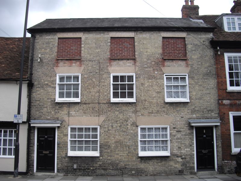
Entry Name: 77 and 79, Brown Street
Listing Date: 12 October 1972
Grade: II
Source: Historic England
Source ID: 1248878
English Heritage Legacy ID: 318884
ID on this website: 101248878
Location: The Friary, Wiltshire, SP1
County: Wiltshire
Civil Parish: Salisbury
Built-Up Area: Salisbury
Traditional County: Wiltshire
Lieutenancy Area (Ceremonial County): Wiltshire
Church of England Parish: Salisbury St Martin
Church of England Diocese: Salisbury
Tagged with: Building
BROWN STREET
1.
1594
(East Side)
Nos 77 & 79
SU 1429 NE 4/151
II GV
2.
Early C19 pair of cottages. 3 storeys white brick. Low pitch gable end slate
roof with flat eaves. 3 windows to upper floors, one false centre 1st floor.
2 light wood casements. 2 panelled doors, one window and C19 shop under projecting
hood on ground floor.
Nos 71A and 75 to 81 (odd) form a group.
Listing NGR: SU1465029728
External links are from the relevant listing authority and, where applicable, Wikidata. Wikidata IDs may be related buildings as well as this specific building. If you want to add or update a link, you will need to do so by editing the Wikidata entry.


Other nearby listed buildings