Approximate Location Map
Large Map »
Latitude: 51.0695 / 51°4'10"N
Longitude: -1.7925 / 1°47'33"W
OS Eastings: 414634
OS Northings: 130040
OS Grid: SU146300
Mapcode National: GBR 517.X70
Mapcode Global: FRA 7649.7HP
Plus Code: 9C3W3694+RX
Entry Name: 24, Winchester Street
Listing Date: 12 October 1972
Grade: II
Source: Historic England
Source ID: 1243347
English Heritage Legacy ID: 447102
ID on this website: 101243347
Location: Salisbury, Wiltshire, SP1
County: Wiltshire
Civil Parish: Salisbury
Built-Up Area: Salisbury
Traditional County: Wiltshire
Lieutenancy Area (Ceremonial County): Wiltshire
Church of England Parish: Salisbury St Thomas and St Edmund
Church of England Diocese: Salisbury
Tagged with: Building
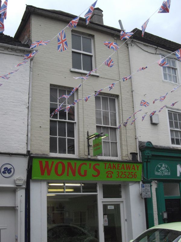
WINCHESTER STREET
1.
1594 (South Side)
No 24
SU 1430 SE 2/600
II GV
2.
Early C19. 3 storeys narrow painted brick front. Low pitch hipped slate roof.
1 central sash to 2nd floor. 2 tall narrow sashes on Ist floor. All recessed,
glazing bars intact, stucco flat arches. Ground floor has plain Victorian
shop front.
Nos 18 to 26 (even) & 30 to 44 (even) form a group.
Listing NGR: SU1463430040
External links are from the relevant listing authority and, where applicable, Wikidata. Wikidata IDs may be related buildings as well as this specific building. If you want to add or update a link, you will need to do so by editing the Wikidata entry.


Other nearby listed buildings
