Latitude: 51.3276 / 51°19'39"N
Longitude: 0.1756 / 0°10'32"E
OS Eastings: 551677
OS Northings: 160971
OS Grid: TQ516609
Mapcode National: GBR T2.0YF
Mapcode Global: VHHPD.0W6M
Plus Code: 9F3285HG+26
Entry Name: Kennel Cottage
Listing Date: 16 January 1975
Grade: II
Source: Historic England
Source ID: 1243732
English Heritage Legacy ID: 447962
ID on this website: 101243732
Location: Shoreham, Sevenoaks, Kent, TN14
County: Kent
District: Sevenoaks
Civil Parish: Shoreham
Traditional County: Kent
Lieutenancy Area (Ceremonial County): Kent
Church of England Parish: Shoreham St Peter and St Paul
Church of England Diocese: Rochester
Tagged with: Cottage
1.
5280 SHOREHAM SHOREHAM
Water Lane
Kennel Cottage
TQ 56 SW 38/1227
II
2.
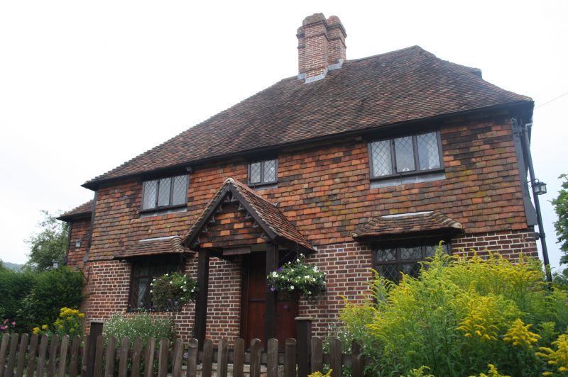
C16 timber framed building with renewed front. 2 storeys, 3 windows. Hipped
tiled roof with later centre stack. C19 casements in old frames. Tile hung
1st floor, brick ground floor. Plain boarded door in projecting tiled porch.
Listing NGR: TQ5167760971
External links are from the relevant listing authority and, where applicable, Wikidata. Wikidata IDs may be related buildings as well as this specific building. If you want to add or update a link, you will need to do so by editing the Wikidata entry.


Other nearby listed buildings