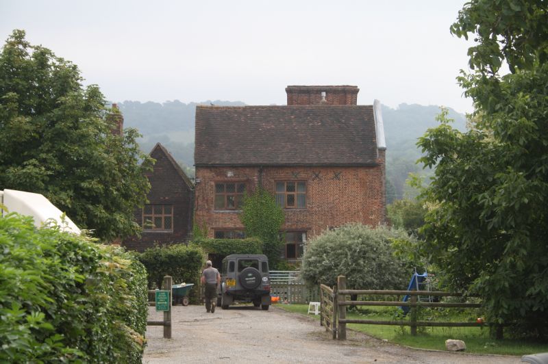
Latitude: 51.3259 / 51°19'33"N
Longitude: 0.1745 / 0°10'28"E
OS Eastings: 551605
OS Northings: 160779
OS Grid: TQ516607
Mapcode National: GBR T2.6P8
Mapcode Global: VHHPC.ZX3Y
Plus Code: 9F3285GF+9R
Entry Name: Filston Hall Farmhouse
Listing Date: 10 September 1954
Grade: II*
Source: Historic England
Source ID: 1243841
English Heritage Legacy ID: 447987
ID on this website: 101243841
Location: Shoreham, Sevenoaks, Kent, TN14
County: Kent
District: Sevenoaks
Civil Parish: Shoreham
Traditional County: Kent
Lieutenancy Area (Ceremonial County): Kent
Church of England Parish: Shoreham St Peter and St Paul
Church of England Diocese: Rochester
Tagged with: Farmhouse
1. 5280 SHOREHAM SHOREHAM Filston Lane (East Side)
Filston Hall Farmhouse TQ 56 SW 38/1185
II*
2. Date of C16 in stone over entrance, but much of he interior is early C17, with a late mediaeval timber framed part. Large manor farmhouse, irregular in shape and surrounded by mediaeval moat and approached on the west side over old mediaeval bridge. Tile main elevation faces south with recently restored brick facade of 3 storeys with masked brick gable ends and half basement lights. Restored mullioned and transomed windows with square paned and lattice casements. Tudor brick coupled stacks. Elevation facing west of 2 storeys with ridge tile roof and tiled gable end to left. The interior contains some very fine panelling and an exceptionally fine staircase. The general character of the house is Jacobean throughout although the kitchen wing is very much older. Some original mullioned and transomed windows with old iron casements. C17 cellar. Crown post roof complete in north wing.
Listing NGR: TQ5108160064
External links are from the relevant listing authority and, where applicable, Wikidata. Wikidata IDs may be related buildings as well as this specific building. If you want to add or update a link, you will need to do so by editing the Wikidata entry.


Other nearby listed buildings