Latitude: 53.8463 / 53°50'46"N
Longitude: -2.0989 / 2°5'56"W
OS Eastings: 393590
OS Northings: 438905
OS Grid: SD935389
Mapcode National: GBR FRSY.DY
Mapcode Global: WHB7S.QLQ5
Plus Code: 9C5VRWW2+GC
Entry Name: Bank House Bridge
Listing Date: 26 October 1964
Grade: II*
Source: Historic England
Source ID: 1243830
English Heritage Legacy ID: 186421
Also known as: Bank House Bridge, Wycoller
ID on this website: 101243830
Location: Wycoller, Pendle, Lancashire, BB8
County: Lancashire
District: Pendle
Civil Parish: Trawden Forest
Traditional County: Lancashire
Lieutenancy Area (Ceremonial County): Lancashire
Church of England Parish: Trawden St Mary
Church of England Diocese: Blackburn
Tagged with: Footbridge
SD 9339 TRAWDEN WYCOLLER ROAD
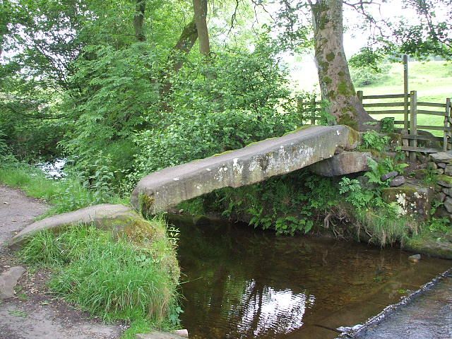
17/255 Bank House Bridge
26.10.64
- II*
Single span clapper bridge,undateable, of millstone grit. One side restored to
take supports for wooden handrail. Clapper is supported at each end by rude
stone piers. Scheduled ancient monument.
External links are from the relevant listing authority and, where applicable, Wikidata. Wikidata IDs may be related buildings as well as this specific building. If you want to add or update a link, you will need to do so by editing the Wikidata entry.


Other nearby listed buildings