Approximate Location Map
Large Map »
Latitude: 51.0886 / 51°5'19"N
Longitude: -0.7087 / 0°42'31"W
OS Eastings: 490533
OS Northings: 132937
OS Grid: SU905329
Mapcode National: GBR DCS.MN9
Mapcode Global: FRA 96D7.PQX
Plus Code: 9C3X37QR+CG
Entry Name: 44, High Street
Listing Date: 19 September 1977
Grade: II
Source: Historic England
Source ID: 1244065
English Heritage Legacy ID: 448796
ID on this website: 101244065
Location: Haslemere, Waverley, Surrey, GU27
County: Surrey
District: Waverley
Civil Parish: Haslemere
Built-Up Area: Haslemere
Traditional County: Surrey
Lieutenancy Area (Ceremonial County): Surrey
Church of England Parish: Haslemere
Church of England Diocese: Guildford
Tagged with: Building
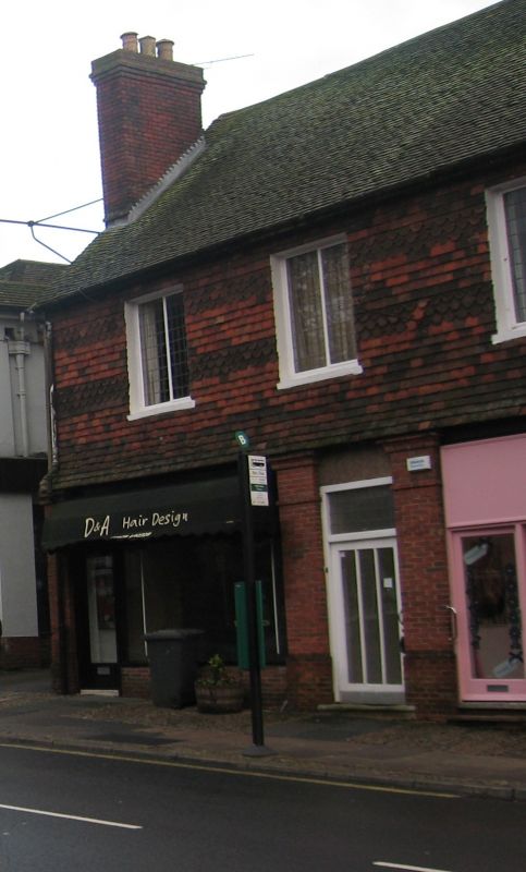
HIGH STREET
1.
5393
(East Side)
No 44
SU 9032 NE 4/72
II
2.
C18 with alterations. Two storeys, 3 windows. High pitched tiled roof with rebuilt
end chimneys. Tile hung 1st floor with fishscale bands. Modern brick ground floor
with 2 plate glass shop windows and central door.
Listing NGR: SU9053332937
External links are from the relevant listing authority and, where applicable, Wikidata. Wikidata IDs may be related buildings as well as this specific building. If you want to add or update a link, you will need to do so by editing the Wikidata entry.


Other nearby listed buildings
