Approximate Location Map
Large Map »
Latitude: 51.2677 / 51°16'3"N
Longitude: -0.9327 / 0°55'57"W
OS Eastings: 474557
OS Northings: 152603
OS Grid: SU745526
Mapcode National: GBR C80.K0D
Mapcode Global: VHDXS.SD8J
Plus Code: 9C3X7398+3W
Entry Name: Poland Farmhouse
Listing Date: 26 June 1987
Grade: II
Source: Historic England
Source ID: 1244448
English Heritage Legacy ID: 449532
ID on this website: 101244448
Location: Hart, Hampshire, RG29
County: Hampshire
District: Hart
Civil Parish: Odiham
Traditional County: Hampshire
Lieutenancy Area (Ceremonial County): Hampshire
Church of England Parish: Odiham All Saints
Church of England Diocese: Winchester
Tagged with: Farmhouse
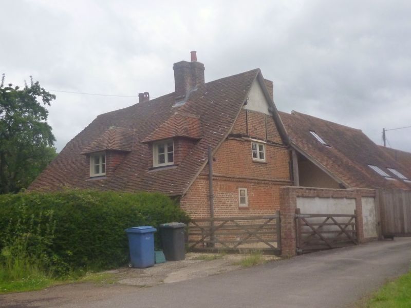
SU 75 SW ODIHAM POLAND LANE
8/37 Poland Farmhouse
-
GV II
C17, C18. 2 storeys, irregular fenestration. Red tile roof, whip at
west end and catslide to south; large (circa 1900) hipped dormer on south
side. Walling is mainly bricknogged timber-frame, with brickwork around
the east end, with 1st floor band, cambered openings and plinth. Casements.
Plain doors in solid frames.
Listing NGR: SU7455652604
External links are from the relevant listing authority and, where applicable, Wikidata. Wikidata IDs may be related buildings as well as this specific building. If you want to add or update a link, you will need to do so by editing the Wikidata entry.


Other nearby listed buildings
