Approximate Location Map
Large Map »
Latitude: 53.1096 / 53°6'34"N
Longitude: -1.5535 / 1°33'12"W
OS Eastings: 429988
OS Northings: 357030
OS Grid: SK299570
Mapcode National: GBR 599.41C
Mapcode Global: WHCDW.33JF
Plus Code: 9C5W4C5W+RJ
Entry Name: Side Walls and Curbs to Cromford Canal Basin and Feeder Channel
Listing Date: 8 May 1992
Grade: II
Source: Historic England
Source ID: 1244632
English Heritage Legacy ID: 449886
ID on this website: 101244632
Location: Cromford, Derbyshire Dales, Derbyshire, DE4
County: Derbyshire
District: Derbyshire Dales
Civil Parish: Cromford
Built-Up Area: Cromford
Traditional County: Derbyshire
Lieutenancy Area (Ceremonial County): Derbyshire
Church of England Parish: Cromford St Mary
Church of England Diocese: Derby
Tagged with: Wall
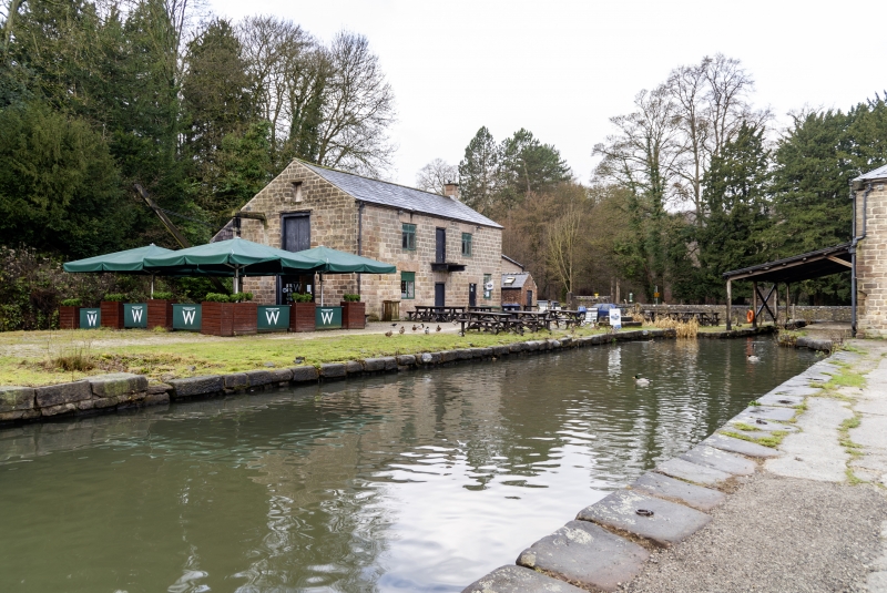
SK 2857/2957 CROMFORD MILL ROAD
668-0/2/10005 Side walls and curbs to
Cromford Canal Basin and
feeder channel
GV II
Canal sidewalls and curbs. c1820, For the Cromford Canal Company engineer William Jessop; the c1820 feeder channel proposed by Benjamin Outram. Gritstone. The basin is lined on its north side by approximately 200 metres of stone edging with various iron rings set into the curbs. The basin funnels into a narrow dock adjacent to the northern warehouse (qv). The edging continues around central wharf and lines a southern limb of the canal adjacent to the southern warehouse (qv). This channel turns to the south to follow the line of Mill Road - it receives water from Cromford Mill via a culvert thus feeding the canal basin. The feeder channel was added when a piped feed from the Mill proved inadequate. The arch in the feeder channel sidewall (close to the gritstone post) bears the date 1821. The roadside channel is protected by a wooden handrail partly fixed on early C19 cast-iron posts and terminating at the shaped gritstone post which bears the date 182_.
Listing NGR: SK2998857029
External links are from the relevant listing authority and, where applicable, Wikidata. Wikidata IDs may be related buildings as well as this specific building. If you want to add or update a link, you will need to do so by editing the Wikidata entry.


Other nearby listed buildings
