Latitude: 53.2149 / 53°12'53"N
Longitude: -1.6733 / 1°40'24"W
OS Eastings: 421910
OS Northings: 368699
OS Grid: SK219686
Mapcode National: GBR 57S.HRD
Mapcode Global: WHCD7.8GF7
Plus Code: 9C5W687G+XM
Entry Name: Perimeter Wall to Gardens at Ends and Rear of Numbers 1-6 (Consecutive)
Listing Date: 20 May 1974
Last Amended: 5 December 1997
Grade: II
Source: Historic England
Source ID: 1245882
English Heritage Legacy ID: 468109
ID on this website: 101245882
Location: Bakewell, Derbyshire Dales, Derbyshire, DE45
County: Derbyshire
District: Derbyshire Dales
Civil Parish: Bakewell
Built-Up Area: Bakewell
Traditional County: Derbyshire
Lieutenancy Area (Ceremonial County): Derbyshire
Church of England Parish: Bakewell All Saints
Church of England Diocese: Derby
Tagged with: Wall
BAKEWELL
SK2168 CASTLE STREET 831-1/4/76 (East side) 20/05/74 Perimeter wall to gardens at ends and rear of Nos.1-6 (consecutive) (Formerly Listed as: CASTLE STREET (East side) End and rear Garden Wall of Nos.1-6 (consec))
GV II
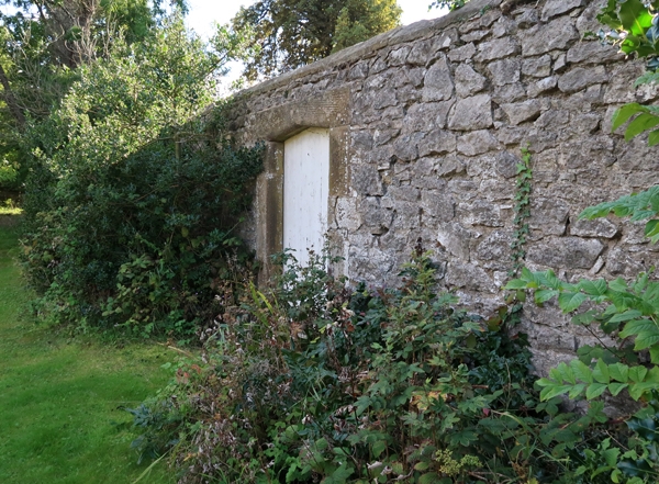
Garden walls. Early-mid C19. Limestone rubble with sandstone dressings. Rectangular wall of approximately 1.75m and more in height which lines Castle Street and returns to enclose the gardens to Nos 1-6, Castle Street (qv); the rear section lines the bank of the River Wye. Walls facing Castle Street: triangular copings; the wall steps up near each end of the terrace to allow for doorways with moulded Tudor-arched surrounds. The rear section of wall increases in height towards the south and is pierced by several triangular-headed gateways one of which has been widened. The wall forms an important townscape feature at the approach to the town via Bakewell Bridge (qv).
Listing NGR: SK2191068699
External links are from the relevant listing authority and, where applicable, Wikidata. Wikidata IDs may be related buildings as well as this specific building. If you want to add or update a link, you will need to do so by editing the Wikidata entry.


Other nearby listed buildings