Latitude: 53.2154 / 53°12'55"N
Longitude: -1.6743 / 1°40'27"W
OS Eastings: 421846
OS Northings: 368753
OS Grid: SK218687
Mapcode National: GBR 57S.HHK
Mapcode Global: WHCD7.7FZV
Plus Code: 9C5W688G+57
Entry Name: Milford Bridge
Listing Date: 20 May 1974
Grade: II
Source: Historic England
Source ID: 1245884
English Heritage Legacy ID: 468111
ID on this website: 101245884
Location: Bakewell, Derbyshire Dales, Derbyshire, DE45
County: Derbyshire
District: Derbyshire Dales
Civil Parish: Bakewell
Built-Up Area: Bakewell
Traditional County: Derbyshire
Lieutenancy Area (Ceremonial County): Derbyshire
Church of England Parish: Bakewell All Saints
Church of England Diocese: Derby
Tagged with: Bridge
BAKEWELL
SK2168 CASTLE STREET 831-1/4/78 Milford Bridge 20/05/74
GV II
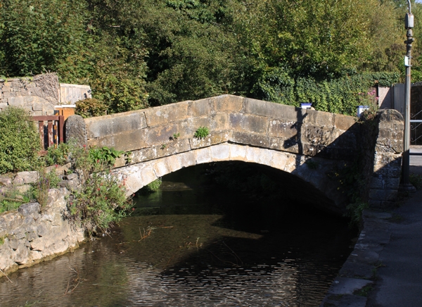
Bridge. Late C18-early C19. Ashlar sandstone; limestone rubble in the spandrels. A small hump-backed bridge with segmental arch and peaked band beneath parapet formed by 2 deep courses of ashlar. Parapet terminates at round-headed piers to north; at south end (to Castle Street) are short returns of coped walling. Spans the canalized tailrace to Victoria Mill, Buxton Road (qv) close to the point where the waters return to the River Wye.
Listing NGR: SK2184668753
External links are from the relevant listing authority and, where applicable, Wikidata. Wikidata IDs may be related buildings as well as this specific building. If you want to add or update a link, you will need to do so by editing the Wikidata entry.


Other nearby listed buildings