Latitude: 51.8642 / 51°51'51"N
Longitude: -2.2491 / 2°14'56"W
OS Eastings: 382946
OS Northings: 218433
OS Grid: SO829184
Mapcode National: GBR 1L5.271
Mapcode Global: VH94B.YDWR
Plus Code: 9C3VVQ72+M9
Entry Name: North End of West Range, Blackfriars
Listing Date: 23 January 1952
Last Amended: 15 December 1998
Grade: I
Source: Historic England
Source ID: 1245991
English Heritage Legacy ID: 472094
ID on this website: 101245991
Location: Gloucester, Gloucestershire, GL1
County: Gloucestershire
District: Gloucester
Electoral Ward/Division: Westgate
Parish: Non Civil Parish
Built-Up Area: Gloucester
Traditional County: Gloucestershire
Lieutenancy Area (Ceremonial County): Gloucestershire
Church of England Parish: Hempsted with Gloucester, Saint Mary de Lode and Saint Mary de Crypt
Church of England Diocese: Gloucester
Tagged with: Building
GLOUCESTER
SO8218SE BLACKFRIARS 844-1/11/14 (South side) 23/01/52 North End of West Range, Blackfriars (Formerly Listed as: LADYBELLEGATE STREET Part of No.11 (occupied by Gloucester Printers Ltd) and Nos 13 to 17 (odd))
GV I
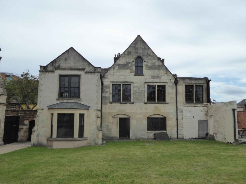
Includes: North End of West Range, Blackfriars LADYBELLEGATE STREET. Part of Dominican friary (Blackfriars), the north end of the west claustral range converted and extended as a house. Mid C13, remodelled 1540-45 as part of house or as cloth manufactory for Sir Thomas Bell; late C18 alterations and additions; now in the care of English Heritage. Stone rubble with dressed stone features, ashlar, brick, slate roof. PLAN: north end of C13 range divided from the main part of the range (the refectory) by C13 cross wall; a small closet wing added on the west side in late C18 and a gabled wing on the east side with a further cross wing projecting north. EXTERIOR: two storeys and cellar; the upper storey now opened into the former attic. The north gable-end of the range remodelled as main front of the house with ashlar facing and coped gable; the ground floor, partly obscured by a temporary building to the north, has a three-light, stone-framed mullion window to right; on the first floor a symmetrical pair of stone-framed mullion windows of two lights with moulded architraves; a similar two-light window to first floor of wing to right; each light contains a late C18 sash with glazing bars (3x4 panes); in the gable a pointed arched window with hoodmould contains a late C18 sash with intersecting glazing bars in the head. INTERIOR: on the ground floor exposed C13 and C16 masonry and a C19 chimney-piece with a stone surround; exposed above the first floor a remarkable surviving C13 open roof with close-set timber scissor trusses within former attic; cellar formed in late C18. Formerly listed as No.11 Ladybellegate Street. Now part of Ancient Monument which includes Blackfriars Church (qv), in the care of English Heritage.
Listing NGR: SO8294618435
External links are from the relevant listing authority and, where applicable, Wikidata. Wikidata IDs may be related buildings as well as this specific building. If you want to add or update a link, you will need to do so by editing the Wikidata entry.


Other nearby listed buildings