Approximate Location Map
Large Map »
Latitude: 52.7055 / 52°42'19"N
Longitude: -2.7551 / 2°45'18"W
OS Eastings: 349073
OS Northings: 312243
OS Grid: SJ490122
Mapcode National: GBR BJ.2NDB
Mapcode Global: WH8BT.N878
Plus Code: 9C4VP64V+5W
Entry Name: 20 and 21, Belmont
Listing Date: 19 September 1972
Grade: II
Source: Historic England
Source ID: 1246490
English Heritage Legacy ID: 455267
ID on this website: 101246490
Location: Shrewsbury, Shropshire, SY1
County: Shropshire
Civil Parish: Shrewsbury
Built-Up Area: Shrewsbury
Traditional County: Shropshire
Lieutenancy Area (Ceremonial County): Shropshire
Church of England Parish: Shrewsbury St Chad
Church of England Diocese: Lichfield
Tagged with: Building
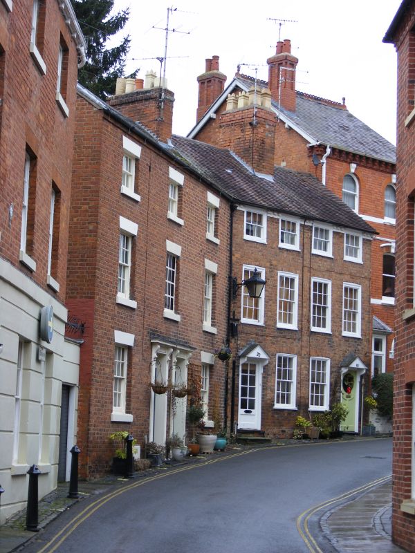
SHREWSBURY
SJ4912SW BELMONT
653-1/15/121 (North West side)
19/09/72 Nos.20 AND 21
GV II
Pair of houses, early C19. Brick with plain tiled roof.
3-storeyed, a narrow frontage of 4 windows with outer doorways
renewed, and 12-pane flush-framed sash windows with
flat-arched heads. Dentilled eaves band, axial stack.
Listing NGR: SJ4907312243
External links are from the relevant listing authority and, where applicable, Wikidata. Wikidata IDs may be related buildings as well as this specific building. If you want to add or update a link, you will need to do so by editing the Wikidata entry.


Other nearby listed buildings
