Approximate Location Map
Large Map »
Latitude: 52.782 / 52°46'55"N
Longitude: -2.202 / 2°12'7"W
OS Eastings: 386474
OS Northings: 320507
OS Grid: SJ864205
Mapcode National: GBR 170.G4C
Mapcode Global: WHBDZ.4BQM
Plus Code: 9C4VQQJX+Q6
Entry Name: Moat Farm House
Listing Date: 31 October 1972
Last Amended: 24 February 1977
Grade: II
Source: Historic England
Source ID: 1247092
English Heritage Legacy ID: 456272
ID on this website: 101247092
Location: Haughton, Stafford, Staffordshire, ST18
County: Staffordshire
District: Stafford
Civil Parish: Haughton
Built-Up Area: Haughton
Traditional County: Staffordshire
Lieutenancy Area (Ceremonial County): Staffordshire
Church of England Parish: Haughton St Giles
Church of England Diocese: Lichfield
Tagged with: Farmhouse
HAUGHTON
l.
2385
SJ 82 SE 14/25 Moat Farm House
II
2.
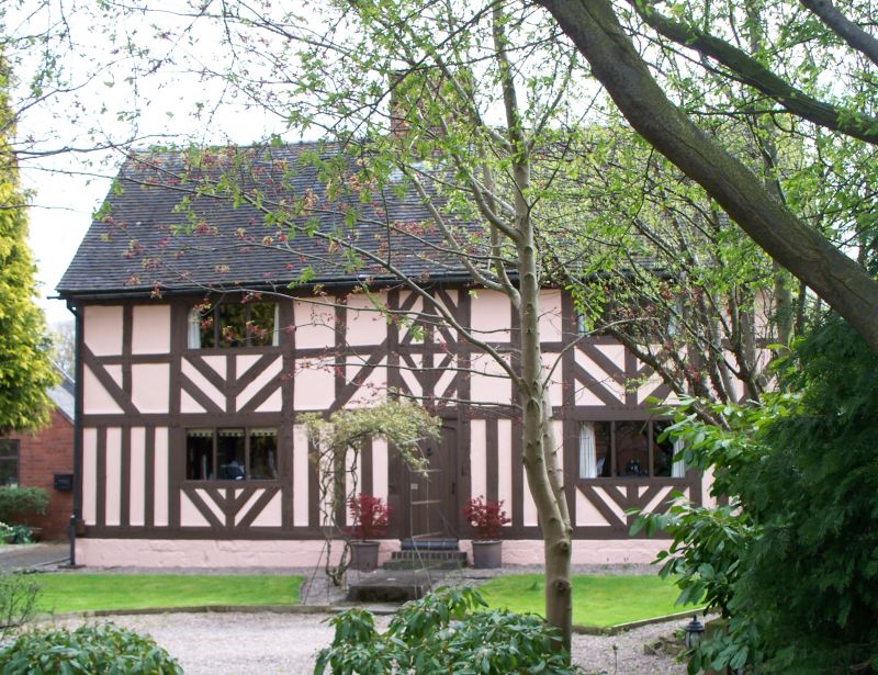
C19 roughcast to earlier timber frame. Probably of medieval origin and a hall house
with chamber floor inserted when the house was altered late Cl7. L-shaped on plan;
2 storeys; C19 and modern casement windows. Front (to west) has 1 C19 casement
and plain modern door with small carved wood panel over head inscribed "Thomas
Reynolds 1680". Gabled ends; with modern barge-boards; central brick stack; old tiles
on north and east sides, modern tiles elsewhere. Interior: Contains original heavy
roof timbers including an arched-braced collar beam truss, also wide fireplace
probably inserted late C17: chamfered ceiling beams. Traces of a moat remain on
north and east boundaries. Reference: Victoria Country History, Vo. IV, pp 136-8.
Moat Farm House shall be amended to read:-
Moat House Farmhouse.
(This building was included in Statutory List of No 5 for the former Rural District of
Stafford dated 31 October 1972, in the old format).
Listing NGR: SJ8647420507
External links are from the relevant listing authority and, where applicable, Wikidata. Wikidata IDs may be related buildings as well as this specific building. If you want to add or update a link, you will need to do so by editing the Wikidata entry.


Other nearby listed buildings
