Latitude: 52.7076 / 52°42'27"N
Longitude: -2.7514 / 2°45'4"W
OS Eastings: 349331
OS Northings: 312476
OS Grid: SJ493124
Mapcode National: GBR BJ.2HBG
Mapcode Global: WH8BT.Q60N
Plus Code: 9C4VP65X+2F
Entry Name: 12, Dogpole
Listing Date: 19 September 1972
Grade: II
Source: Historic England
Source ID: 1247168
English Heritage Legacy ID: 456434
ID on this website: 101247168
Location: Shrewsbury, Shropshire, SY1
County: Shropshire
Civil Parish: Shrewsbury
Built-Up Area: Shrewsbury
Traditional County: Shropshire
Lieutenancy Area (Ceremonial County): Shropshire
Church of England Parish: Shrewsbury St Alkmund
Church of England Diocese: Lichfield
Tagged with: Building
SHREWSBURY
SJ4912SW DOGPOLE 653-1/15/269 (East side) 19/09/72 No.12
GV II
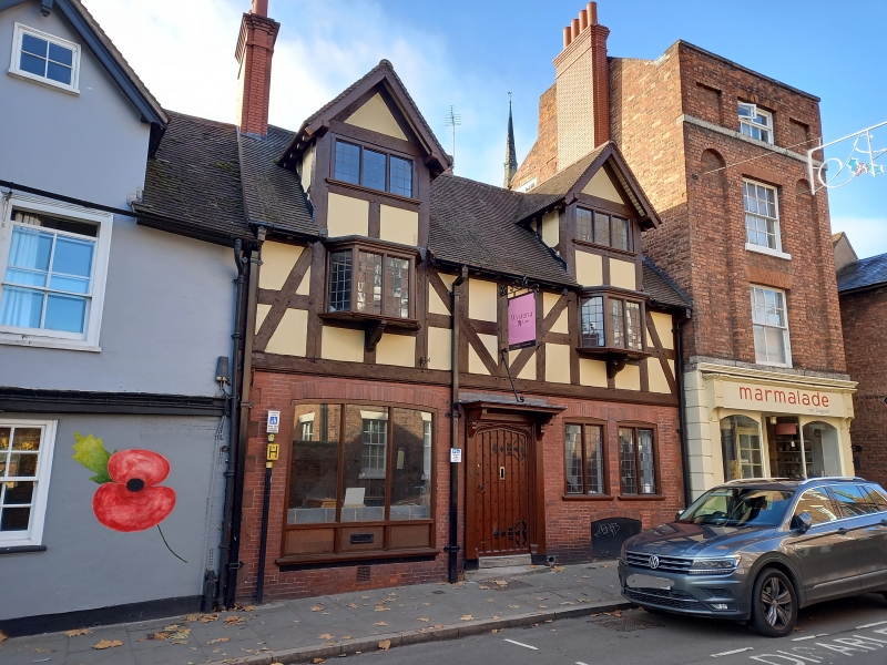
Offices, probably originally dwelling. Possible C17 core, but visible fabric all early C20. Brick to ground floor with timber cladding above. Plain tiled roof. 2 storeyed with high gabled dormers. 2-window range. Central door in 4-centred archway with canopy suspended by a wrought-iron bracket. Paired wood mullioned and transomed windows to right, with leaded lights and cambered brick heads. Left-hand wide shop window, also with cambered brick heads. Timber cladding in imitation of timber-frame above, small square panels with long raking arched braces. 2 oriel windows with wood mullions and leaded lights. 3-light mullioned windows in attic dormers over. Gable end stacks.
Listing NGR: SJ4933112476
External links are from the relevant listing authority and, where applicable, Wikidata. Wikidata IDs may be related buildings as well as this specific building. If you want to add or update a link, you will need to do so by editing the Wikidata entry.


Other nearby listed buildings