Approximate Location Map
Large Map »
Latitude: 51.2157 / 51°12'56"N
Longitude: 0.2471 / 0°14'49"E
OS Eastings: 557039
OS Northings: 148680
OS Grid: TQ570486
Mapcode National: GBR MNS.P9J
Mapcode Global: VHHQ0.7PHW
Plus Code: 9F32668W+7V
Entry Name: The White House
Listing Date: 19 February 1990
Last Amended: 10 May 1999
Grade: II
Source: Historic England
Source ID: 1247990
English Heritage Legacy ID: 179551
ID on this website: 101247990
Location: Hildenborough, Tonbridge and Malling, Kent, TN11
County: Kent
District: Tonbridge and Malling
Civil Parish: Hildenborough
Built-Up Area: Tonbridge
Traditional County: Kent
Lieutenancy Area (Ceremonial County): Kent
Church of England Parish: Hildenborough St John the Evangelist
Church of England Diocese: Rochester
Tagged with: House
TQ 54 NE HILDENBOROUGH COLDHARBOUR LANE
(east side)
5/114 Number 2,
The White House
19.2.90
II
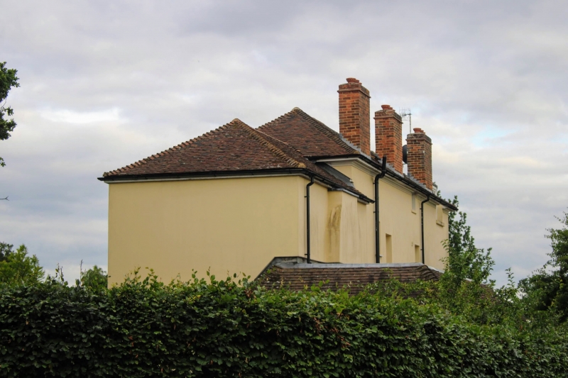
House, originally a lodge to Oakhill (q.v.). Circa 1820 in origin, extended and re-windowed in circa 1850, early and late C20 additions. Stuccoed and blocked out; Tiled roof; brick stacks. Plan: East facing, backing on to Coldharbour Lane. Long rectangular plan, 4 rooms wide and originally single depth throughout. The 1820s arrangement may have been 3 rooms wide, the 3 existing south rooms, each heated by a rear lateral stack. The north end room is a later, circa mid C19 addition and is probably contemporary with a programme of refenestrating the house. The present entrance arrangement, into the first room from the north, is part of the same phase. A small unheated block was added to the rear of this room in the circa early C20 and there has been a 1980s addition wrapping round the north west corner of the house. Exterior: Main block 3 storeys and half basement, right north) end addition 2 storeys. Roof hipped at ends. Asymmetrical 3:1 bay front, one window to the addition. 3 circa mid C19 canted bays to the left, extending from the second floor down to the basement, glazed with long, small-pane casements, the ground floor windows with margin glazing and high transoms. The gabled porch on posts in the third bay cuts into the window above and clearly post dates it; steps up to C20 glazed front door. Small 2-light attic windows. The right end block has a similar canted bay, the first floor window reglazed in the C20; similar bay on the left return of the main block. The rear (west) elevation has a mixture of C19 and C20 timber sashes and casements. Interior: Some early C19 interior features survive. The 2 left hand rooms preserve early C19 cornices and joinery, the partition between the 2 rooms has been removed. The adjoining room to the right, the entrance hall, has an early C 19 stair and chimney-piece. The house overlooks a pond, said originally to be part of the village pound. A deep shaft north of the building was probably an ice house. An attractive C19 house.
Listing NGR: TQ5769749546
External links are from the relevant listing authority and, where applicable, Wikidata. Wikidata IDs may be related buildings as well as this specific building. If you want to add or update a link, you will need to do so by editing the Wikidata entry.


Other nearby listed buildings
