Latitude: 53.1078 / 53°6'28"N
Longitude: -1.5608 / 1°33'38"W
OS Eastings: 429498
OS Northings: 356824
OS Grid: SK294568
Mapcode National: GBR 599.27H
Mapcode Global: WHCDW.041T
Plus Code: 9C5W4C5Q+4M
Entry Name: Conduit to the Rear of Numbers 3-13 Cromford Hill
Listing Date: 12 September 1990
Grade: II
Source: Historic England
Source ID: 1248499
English Heritage Legacy ID: 430128
ID on this website: 101248499
Location: Cromford, Derbyshire Dales, Derbyshire, DE4
County: Derbyshire
District: Derbyshire Dales
Civil Parish: Cromford
Built-Up Area: Cromford
Traditional County: Derbyshire
Lieutenancy Area (Ceremonial County): Derbyshire
Church of England Parish: Cromford St Mary
Church of England Diocese: Derby
Tagged with: Architectural structure
1. CROMFORD HILL (REAR) 1390 CROMFORD
Conduit to the rear of Nos 3-13 Cromford Hill SK 2856/2956 1/107 II GV
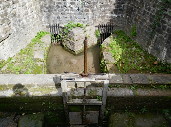
2. Conduit marking congruence of two streams. Probably 1780s as part of Richard Arkwright's Cromford development. Dressed stone sides and cutwater to channels depressed well below ground level and with tall roughly coursed rubble retaining walls, with sluice to one end.
Listing NGR: SK2949856823
External links are from the relevant listing authority and, where applicable, Wikidata. Wikidata IDs may be related buildings as well as this specific building. If you want to add or update a link, you will need to do so by editing the Wikidata entry.


Other nearby listed buildings