Approximate Location Map
Large Map »
Latitude: 51.2802 / 51°16'48"N
Longitude: 1.0793 / 1°4'45"E
OS Eastings: 614847
OS Northings: 157954
OS Grid: TR148579
Mapcode National: GBR TY2.PPC
Mapcode Global: VHLGM.N2FY
Plus Code: 9F3373JH+3P
Entry Name: 7 and 8, Best Lane
Listing Date: 3 May 1967
Grade: II
Source: Historic England
Source ID: 1248704
English Heritage Legacy ID: 170380
ID on this website: 101248704
Location: Canterbury, Kent, CT1
County: Kent
District: Canterbury
Electoral Ward/Division: Westgate
Parish: Non Civil Parish
Built-Up Area: Canterbury
Traditional County: Kent
Lieutenancy Area (Ceremonial County): Kent
Tagged with: Building
1.
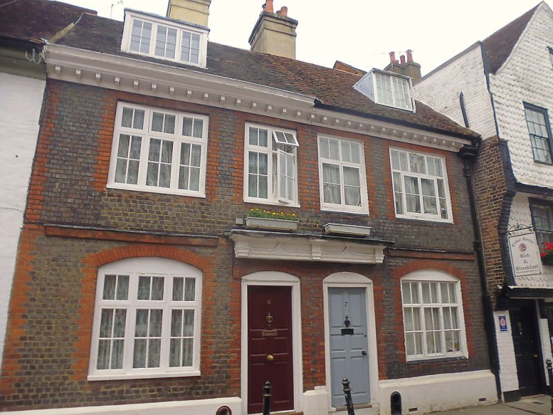
944 BEST LANE
(North West Side)
Nos 7 and 8
TR 1457 NE 4/89A 3.5.67.
II GV
2.
An early C18 pair. 2 storeys brown brick with red brick dressings. Slate
roof. Carved wooden bracket cornice. 4 casement windows. Stringcourse.
Plinth. 2 casements on the ground floor are set in cambered arches. Pair
of doorcases with heavy wooden hoods and 6 fielded panelled doors.
Nos 3 to 12 (consec) form a group.
Listing NGR: TR1484557957
External links are from the relevant listing authority and, where applicable, Wikidata. Wikidata IDs may be related buildings as well as this specific building. If you want to add or update a link, you will need to do so by editing the Wikidata entry.


Other nearby listed buildings
