Approximate Location Map
Large Map »
Latitude: 51.3523 / 51°21'8"N
Longitude: -1.9943 / 1°59'39"W
OS Eastings: 400494
OS Northings: 161467
OS Grid: SU004614
Mapcode National: GBR 2V1.0MJ
Mapcode Global: VHB4G.D82P
Plus Code: 9C3W9224+W7
Entry Name: 5, the Brittox
Listing Date: 19 September 1972
Grade: II
Source: Historic England
Source ID: 1249428
English Heritage Legacy ID: 431556
ID on this website: 101249428
Location: Devizes, Wiltshire, SN10
County: Wiltshire
Civil Parish: Devizes
Built-Up Area: Devizes
Traditional County: Wiltshire
Lieutenancy Area (Ceremonial County): Wiltshire
Church of England Parish: Devizes St John
Church of England Diocese: Salisbury
Tagged with: Building
1.
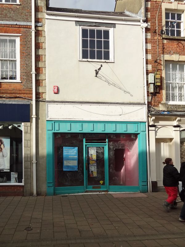
1042 THE BRITTOX
(North West Side)
No 5
SU 0061 3a/227
II GV
2.
C18 recasing of Cl7 building. 2 storeys rough cast. Gable end slate roof
with shallow eaves cornice. 1 window, sash, glazing bars, moulded flush
frame. Modern shop front. Link value.
Nos 4 to 7 (consec) form a group.
Listing NGR: SU0049161467
External links are from the relevant listing authority and, where applicable, Wikidata. Wikidata IDs may be related buildings as well as this specific building. If you want to add or update a link, you will need to do so by editing the Wikidata entry.


Other nearby listed buildings
