Approximate Location Map
Large Map »
Latitude: 51.3557 / 51°21'20"N
Longitude: -2.0096 / 2°0'34"W
OS Eastings: 399429
OS Northings: 161842
OS Grid: ST994618
Mapcode National: GBR 2TT.W7F
Mapcode Global: VHB4G.36Z3
Plus Code: 9C3V9X4R+75
Entry Name: Garden Wall to Dunkirk House
Listing Date: 19 September 1972
Grade: II
Source: Historic England
Source ID: 1249471
English Heritage Legacy ID: 431598
ID on this website: 101249471
Location: Wiltshire, SN10
County: Wiltshire
Civil Parish: Devizes
Built-Up Area: Devizes
Traditional County: Wiltshire
Lieutenancy Area (Ceremonial County): Wiltshire
Church of England Parish: Devizes St Peter
Church of England Diocese: Salisbury
Tagged with: Wall
1.
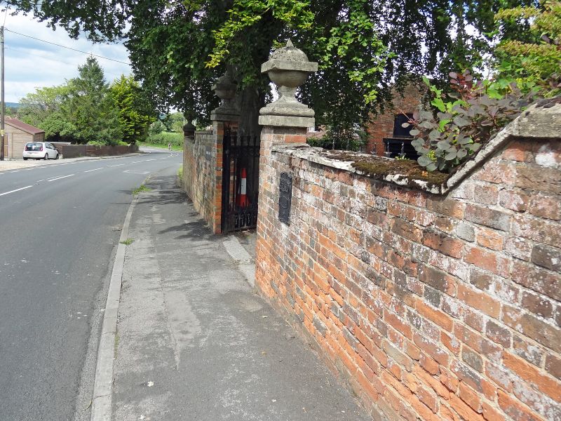
1042 DUNKIRK
Garden Wall of
Dunkirk House
ST 9961 1/189A
II GV
2.
Red brick wall with stone coping, lowered, up hill to south. Crowned by
stone ball spiked finials at corners and flanking double cast iron gates,
plain but with foliate top colonette (Cl9) dividing them.
Dunkirk House and Hillside with their garden walls form a group.
Listing NGR: ST9942961842
External links are from the relevant listing authority and, where applicable, Wikidata. Wikidata IDs may be related buildings as well as this specific building. If you want to add or update a link, you will need to do so by editing the Wikidata entry.


Other nearby listed buildings
