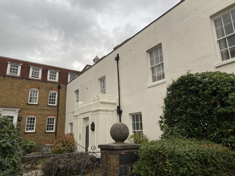
Latitude: 51.5711 / 51°34'16"N
Longitude: -0.1145 / 0°6'52"W
OS Eastings: 530770
OS Northings: 187492
OS Grid: TQ307874
Mapcode National: GBR FN.RSQ
Mapcode Global: VHGQL.YRVY
Plus Code: 9C3XHVCP+F6
Entry Name: Stapleton Hall
Listing Date: 23 July 1986
Grade: II
Source: Historic England
Source ID: 1249623
English Heritage Legacy ID: 201528
ID on this website: 101249623
Location: Stroud Green, Haringey, London, N4
County: London
District: Haringey
Electoral Ward/Division: Stroud Green
Parish: Non Civil Parish
Built-Up Area: Haringey
Traditional County: Middlesex
Lieutenancy Area (Ceremonial County): Greater London
Church of England Parish: Holy Trinity Stroud Green
Church of England Diocese: London
Tagged with: House
1. 4415 STAPLETON HALL ROAD STROUD GREEN, N4 -------------------- TQ 3087 Stapleton Hall 42/SP797
II
2. Substantial house. Circa early C17 with later alterations, including early C19 facade. Timber frame, stuccoed; steeply pitched plain tiled roof to parapet. 2 storeys; small bays. Entrance almost centrally placed with projecting solid sidedlboric pilastered porch. Square headed windows; sashes plate glass. Barn stack to left of centre. Interior with substantial chamfered and stopped beams, parts of original roof structure, broad timber floor boards, etc.
Listing NGR: TQ3077087492
External links are from the relevant listing authority and, where applicable, Wikidata. Wikidata IDs may be related buildings as well as this specific building. If you want to add or update a link, you will need to do so by editing the Wikidata entry.


Other nearby listed buildings