Latitude: 54.7086 / 54°42'31"N
Longitude: -1.2716 / 1°16'17"W
OS Eastings: 447027
OS Northings: 535088
OS Grid: NZ470350
Mapcode National: GBR MFKZ.HW
Mapcode Global: WHD66.FXP5
Plus Code: 9C6WPP5H+C8
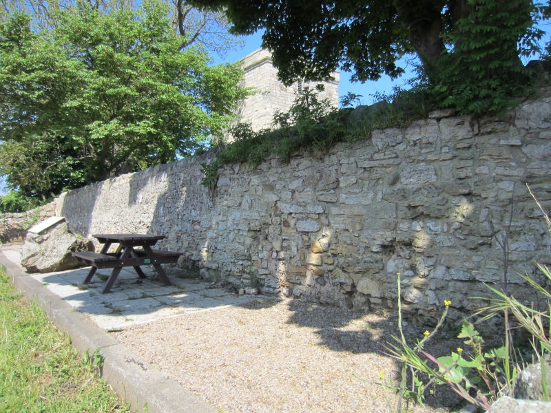
Entry Name: Boundary Wall to West of Church of St Mary Magdalene
Listing Date: 16 November 1967
Last Amended: 17 December 1985
Grade: II*
Source: Historic England
Source ID: 1249899
English Heritage Legacy ID: 432126
ID on this website: 101249899
Location: Hart, Hartlepool, County Durham, TS27
County: Hartlepool
Civil Parish: Hart
Traditional County: Durham
Lieutenancy Area (Ceremonial County): County Durham
Church of England Parish: Hart
Church of England Diocese: Durham
Tagged with: Wall
HART BUTTS LANE NZ 43 NE (off east side) 1/35 Boundary wall to west of 16.11.67 Church of St. Mary Magdalene (formerly listed as Churchyard West Wall)
-- II*
Boundary wall, medieval on Saxon foundation. Random and coursed limestone rubble; approximately 3m. high, it marks the west boundary of the churchyard of St. Mary Magdalene's Church, whilst the west extension of the wall marks the north boundary of Manor Croft. Scheduled Ancient Monument No. 17. (D. Austin, "Archaeologia Aeliana," 5 (IV) ).
Listing NGR: NZ4702835087
External links are from the relevant listing authority and, where applicable, Wikidata. Wikidata IDs may be related buildings as well as this specific building. If you want to add or update a link, you will need to do so by editing the Wikidata entry.


Other nearby listed buildings